
|
|
SUBSIM: The Web's #1 resource for all submarine & naval simulations since 1997
|
SUBSIM: The Web's #1 resource for all submarine & naval simulations since 1997 |
 04-09-11, 02:13 PM
|
#1 |
|
Ocean Warrior
 Join Date: Dec 2010
Location: Montreal, Canada
Posts: 2,776
Downloads: 833
Uploads: 11
|
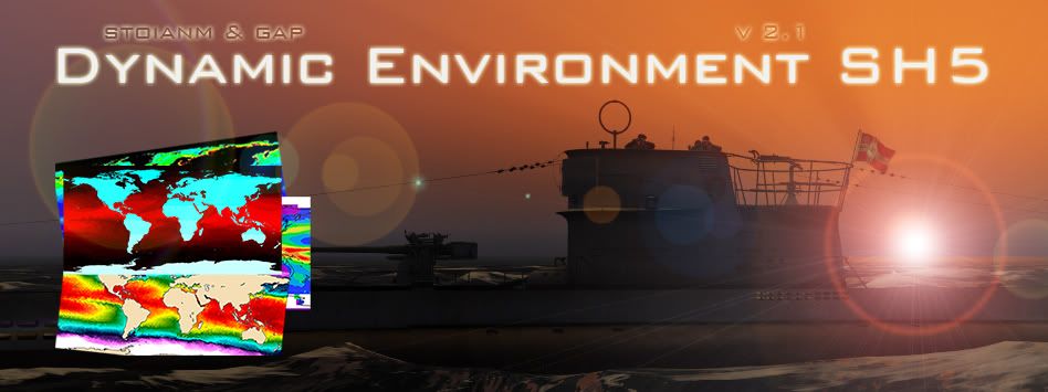 § Description: Dynamic Environment SH5 v 2.1 § Authors: stoianm & gap § About this mod: The weather randomly generated by Silent Hunter 5, as it is out of the box, tends to be quite static. This mod addresses the problem, aiming to enhance the game experience. Not only it offers better looking and immersive environments that push game's graphical engine to its limits, it also affects the general playability, by adding in SH5's world several new climatic zones, each with its characteristic colors, seasons, and dynamic weather conditions. For doing so, real data on ocean's main temperatures and turbidity, season's alternations, weather variability, wind speeds, etc, were collected and combined, resulting in an highly variable environment. From now on, planning carefully your patrols based on seasons and locations will be a key factor for succeeding in the campaign, making the difference between the newbie and the experienced U-boot kaulein! § Main mod features: · main mod available in 3 versions with different underwater visibility, impurity, fog, color correction and filter parameters: light version (for very high underwater transparency, low fog density, etc.), realistic version (for the lovers of simulative gaming style) and normal version (intermediate settings); · all versions: added 9 new environment color zones, bringing the total to 12 (stock game features only 3 env_coloros configuration files), each with completely new colors, matching the real ones as close as possible according to footage and pictures available on internet and/or beta testers reports; · all versions: added 9 new climate zones for a total amount of 15 (stock game features only 6 climate zones), each representing realistic seasonal alternations for polar, sub polar, cold temperate, warm temperate, hot temperate, dry tropical and wet tropical climate (for both northern and southern hemisphere), plus equatorial climate (symmetrical); · all versions: added 84 new weather type configuration files for a total amount of 87 (stock game features only 3 climate zones), each with realistic weather variation intervals, and wind speed ranges changing based on climatic zones and seasons; · all versions: ClimateZones.tga completely reworked for representing as precisely as possible on the global map 183 different combinations of the featured color, climate and weather zones; no more ''fixed'' combinations are given, as it was in stock game. · all versions: replaced stock caustics with better HD ones; · many other graphical improvements, 3D textures and effects, etc. § Optional mods features: · Dynamic Environment SH5 - Nights: changes nights brightness; it comes in two versions: brighter nights and darker nights. Intermediate settings are used for the main mod. Whichever version you will use, night time visibility will be affected by time and atmospheric conditions (moon phase, cloud cover, etc); · Dynamic Environment SH5 - Colors: it changes the dominant colors. It comes in two versions: vivid colors (increased saturation for blue component) and realistic colors (balanced saturation); · Dynamic Environment Shallow Waters: it changes the water pixel shader allowing to see seafloor and underwater parts of recently imported .dat units when viewed from above water · Dynamic Environment SH5 - Sleet for Winter Campaigns: changes rain into sleet-like precipitations; · Dynamic Environment SH5 - Sounds: it changes stock environment sounds (wind, wakes, thunders, etc.) with better ones; · Dynamic Environment SH5 - Waves: it changes wave mechanics. It comes in three versions: normal version (better waves than stock game, recommended for low spec systems), realistic version (high waves) and hurricane version (very realistic high waves, but it got small side-effects in sea color and pitch and roll. Also it is heavy on PC performances, so its use is recommended only on high spec computers); · Dynamic Environment SH5 - Floor: replaces stock seabed textures with better HD ones (installation suggested on high spec systems); · Dynamic Environment SH5 - Undersea: replaces stock sea plants and rock textures with new HD ones. It is available in 3 versions, for representing different undersea ecosystems (installation suggested on high spec systems); § Change log: · Dynamic Environment SH5 v 2.1: - fixed an error with incorrect wind speed ranges in some of the weather type zones .cfg files; - fixed a small error with a missing average wind speed area in ClimateZones.tga map; - decreased minimum wind speed value for calm wind areas from 1 to 0; - renamed the optional mod Waves - Realistic Version to Waves - Hurricane Version; - renamed the optional mod Waves - High Version to Waves - Realistic Version; - added a new version of the optional mod Dynamic Environment SH5 - Undersea, to be used into the Mediterranean Sea. · Dynamic Environment SH5 v 2.0 (beta): - increased the number of weather type zones .cfg files from 15 to 87, in order to reflect detailed information on real annual and seasonal wind speed averages measured in different areas of the planet; - reworked ClimateZones.tga map, in order to include the new wind information; increased number of different combination of color, climate and weather types represented on it, from 36 to 183; - included Dynamic Environment SH5 (realistic version) patch into realistic version of the main mod, in order to have more realistic visibility, fog distances and sky saturation; - new water pixel shaders by TheDarkWraith included as optional mod. · Dynamic Environment SH5 (realistic version) patch: - changed underwater visibility, fog distances and sky saturation for realistic version of the main mod; · Dynamic Environment SH5 (first release): - main mod made in 3 versions with different underwater visibility, fog, filter, etc. settings; - changed vanilla settings to have new environment colors zones for a total amount of 12; - changed vanilla settings to have new climate zones for a total amount of 15; - changed vanilla settings to have new weather type zones for a total amount of 15; - replaced vanilla ClimateZones.tga with a new map featuring 36 different combinations of color, climate and weather types. - replaced vanilla caustics effect. - included other effects, textures, etc. - optional mods included: Nights (2 versions), Colors (2 versions), Sleet for Winter Campaigns, Sounds, Waves (3 versions), Floor, Undersea (2 versions). § Compatibility: · this mod is compatible with any version of Silent Hunter 5; · installing other environmental mods or, more in general, enabling any conflicting mod on the top of this one, may cause CTD's or other weird effects. Don't do it, unless you know exactly what you are doing! § Known bugs and limits: · during beta testing no CTD or other major problems have been reported; · due to game limits it was not possible to implement many features, like snow, caustics on rocks and see plants, etc. If possible some of these features will be included in the next releases; · due to the complexity of this mod, the authors cannot exclude minor problems with its use, especially related to game balance and playability during bad weather. Users are invited to report any relevant issue for further fine tuning . § Installation: · look into your main <Silent Hunter 5> installation folder for a subfolder called <MODS> and create it if is not there; · unzip this mod everywhere on your hard drive and go to the <Dynamic Environment SH5/MODS> folder; · depending on the base mod that you want to use, pick one of the subfolders contained in the previous path and drop it in <Silent Hunter 5/MODS> folder; · enable the mod after any other environmental mod (in case you use any) by using JoneSoft Generic Mod Enabler: http://www.users.on.net/~jscones/software/products-jsgme.html; · follow the same steps for installing optional mods contained in <Dynamic Environment SH5/OPTIONAL MODS> path; · you can install both main mod and any of the optional mods anytime during your patrols or in the bunker; · N.B: starting with version 2.0 of the mod, you don---8217;t need any more Dynamic Environment SH5 (realistic version) patch; · N.B: we strongly suggest you to put this mod and its optional mods on the end of your JGSME enabled mods list! § Acknowledgements: · Authors wish to thank the following subsim.com members for their valuable contributions: - Sobers - W_clear - Entheberge - TheDarkWraith - Paris_England - Stormfly - AilantD - Yano1966 · We wish to thank also the whole SH5 modding community for support and suggestions and especially beta tester whose reports helped us greatly in improving this mod. § Disclaimer: · this package is not related to or supported by UBISOFT© nor it is intended for any commercial use; · the authors of this package take no responsibility for any damage occurred to the data in your computer due to its use. · feel free to redistribute this package for free as long as you do not alter it in any part, including this readme; · feel free to use this package -as a whole or in part- for your own freely distributed mod, as far as you get explicit consent by the original authors (including the authors of stuff that this mod is based on) and you give them credits for their work. Because i used the long names for folders you need to use 7zip to uncompres the mod.... download from here===> Link DOWNLOAD Dynamic Environment SH5 - V2.1===> Link or Link Download Dynamic Environment SH5 Shallow Waters V2.1 Patch===> Link or download from here: http://www.mediafire.com/?c97khltzoi598ef Dynamic Environment SH5 v 2.1 - Fixes pack Last edited by stoianm; 09-01-13 at 05:41 PM. |

|

|
|
|


 Threaded Mode