
|
|
SUBSIM: The Web's #1 resource for all submarine & naval simulations since 1997
|
SUBSIM: The Web's #1 resource for all submarine & naval simulations since 1997 |
 04-27-22, 12:53 PM
|
#61 |
|
GLOBAL MODDING TERRORIST

Join Date: Sep 2014
Posts: 5,655
Downloads: 137
Uploads: 0


|
I get what was done.
All 3 sectors were not adjusted and tested properly. Now I'm working on a way to have 010 check the 6 pixel boarder areas around any given RAW file/files. So the script would read the 1st 6 lines of 601 bytes each. Then read the next 6 bytes then skip to the last 6 bytes of the lines until we reach the last 6 lines which would read them start to end. That would give us the border information for a RAW. Run it on all sectors touching? You'd have a table that would not need slight color guessing. I did check sectors in the area in question but I looked at the upper and lower sectors! Not the left or right sectors. Doh! Another thing I'm working on is to change the UI of the program to allow a bigger image when using it. Also trying to change it so that damned header information is removed when exporting from the ZHF files. |

|

|
|
04-27-22, 01:42 PM
|
#62 |
|
中国水兵
 Join Date: Jun 2019
Posts: 278
Downloads: 558
Uploads: 0
|
If I understand the situation correctly, then the error "with a pixel" occurs when I start the game with ready-made squares
ZHF 1 and 3 (figuratively speaking). When the game has already loaded them onto the map. I think if I didn't load them into the game if I had finished square 2, and then loaded three finished squares into the game at once, this error would not have occurred ... |
|
|
|
|
04-27-22, 01:50 PM
|
#63 |
|
GLOBAL MODDING TERRORIST
Join Date: Sep 2014
Posts: 5,655
Downloads: 137
Uploads: 0
|
Correct.
|
|
|
|
|
04-27-22, 10:46 PM
|
#64 | |
|
CTD - it's not just a job
Join Date: May 2016
Location: One hour from Music City USA!
Posts: 10,106
Downloads: 451
Uploads: 2


|
Quote:
__________________
"...and bollocks to the naysayers" - Jimbuna |
|
|
|
|
|
04-28-22, 02:49 AM
|
#65 |
|
中国水兵
Join Date: Jun 2019
Posts: 278
Downloads: 558
Uploads: 0
|
Average depth indicators in the game:
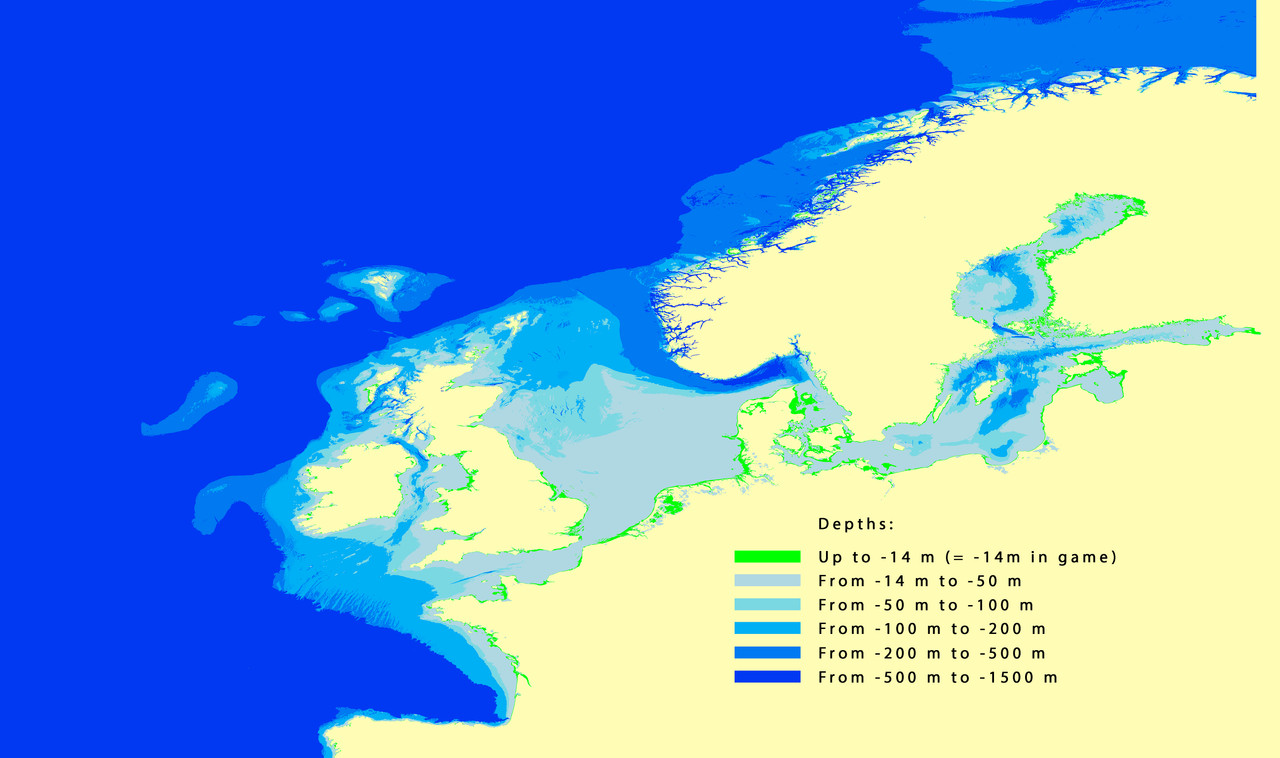 This is how the depths look in Photoshop: 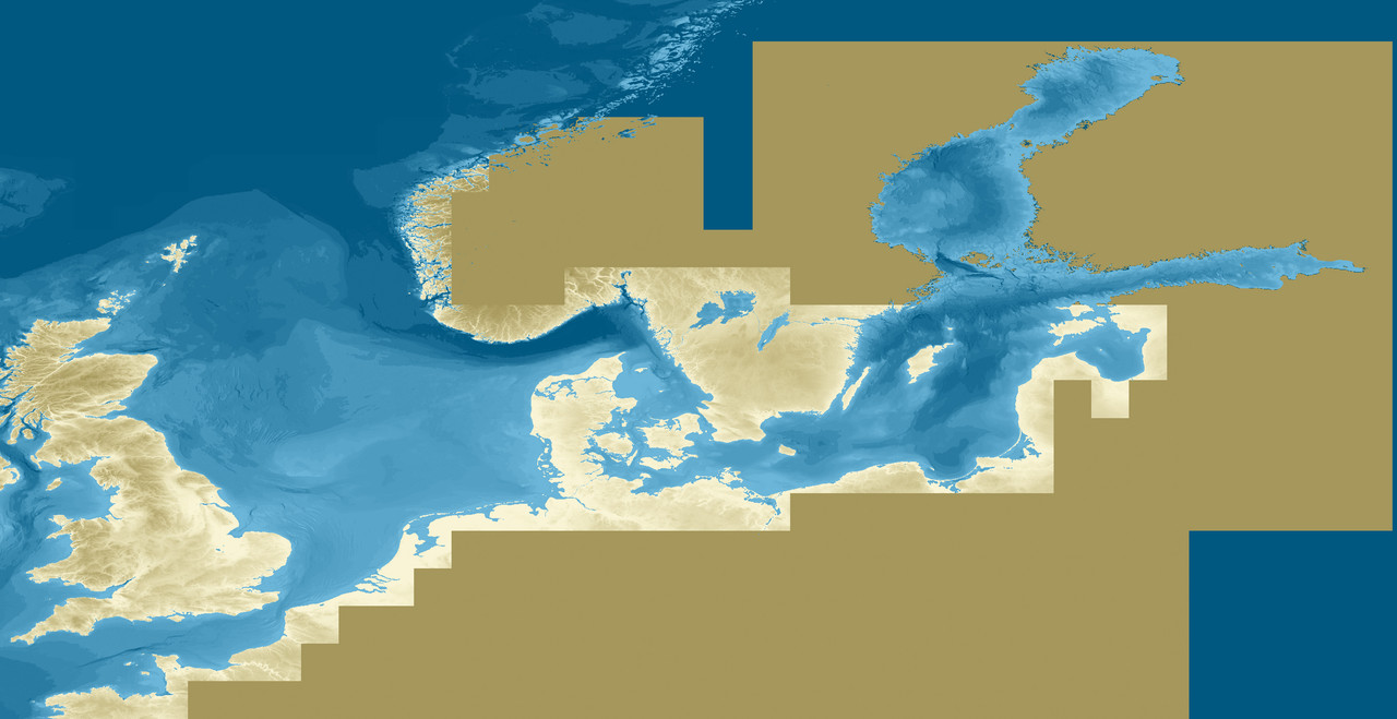 Dogger Bank in SH3  Dogger Bankr in SH4  Dogger Bank in SH4 game:   -------------------------------------------------- -------------------------------------- English Channel in SH3: 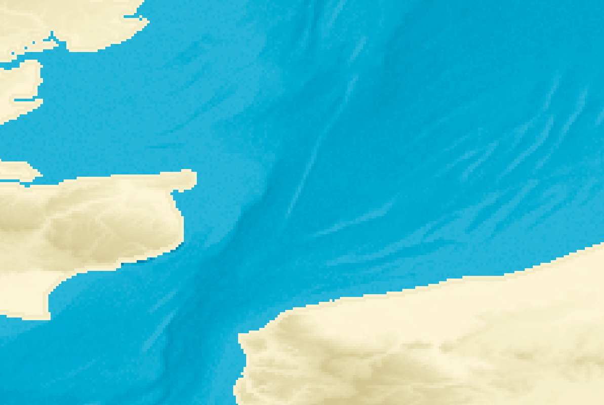 English Channel in SH4: 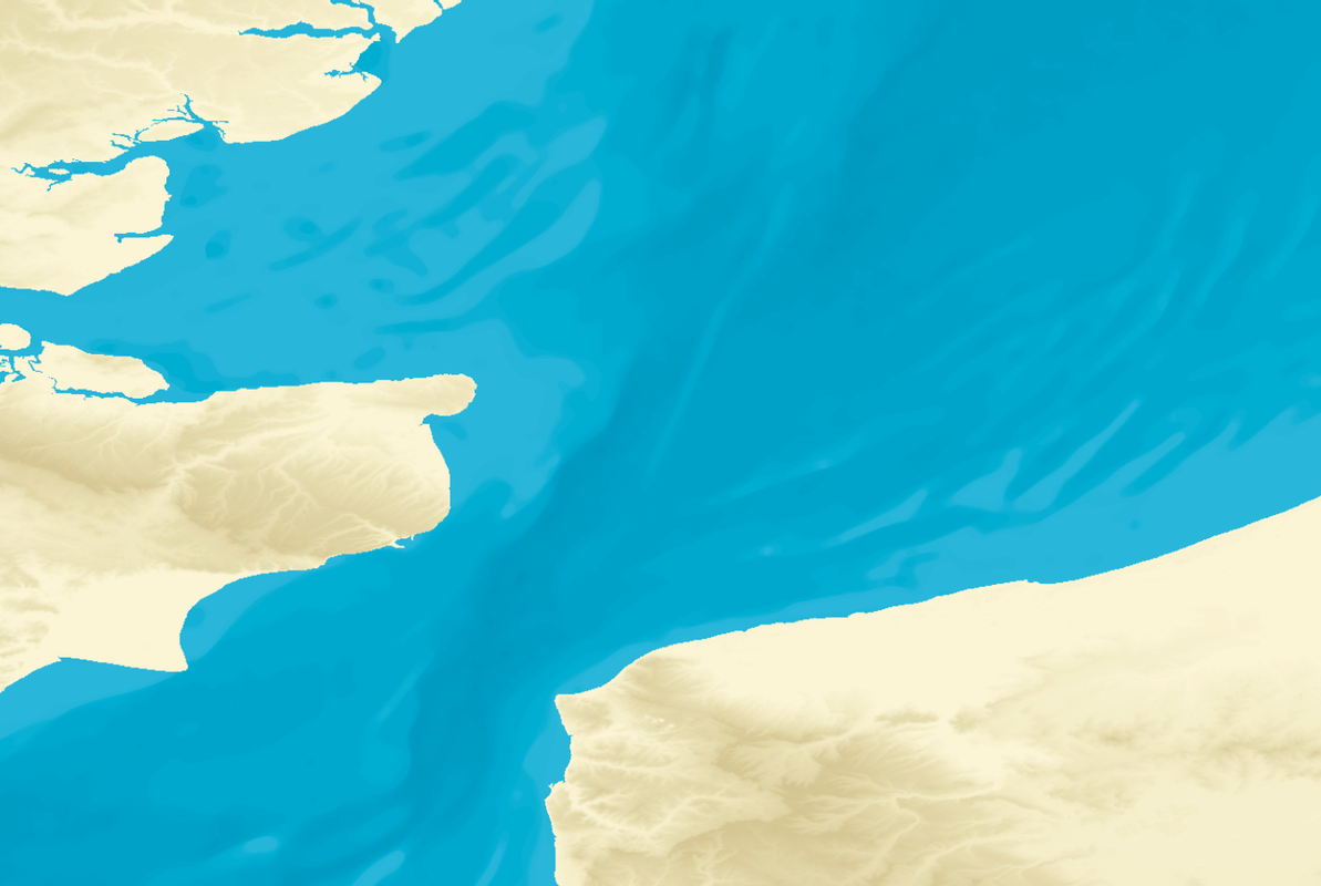 The English Channel in SH4: 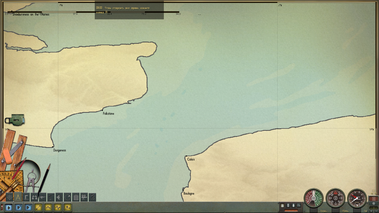 -------------------------------------------------- ------------------------------------ North Sea in its upper part: In SH3: 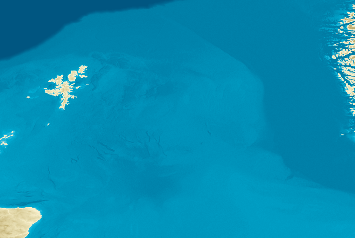 In SH4: 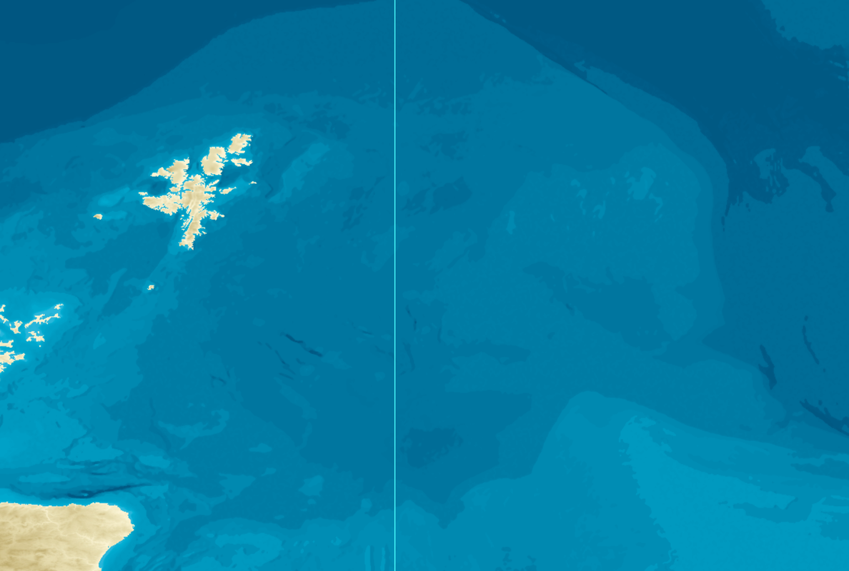 -------------------------------------------------- ---------------------------------------- Wilhelmshaffen in SH3: 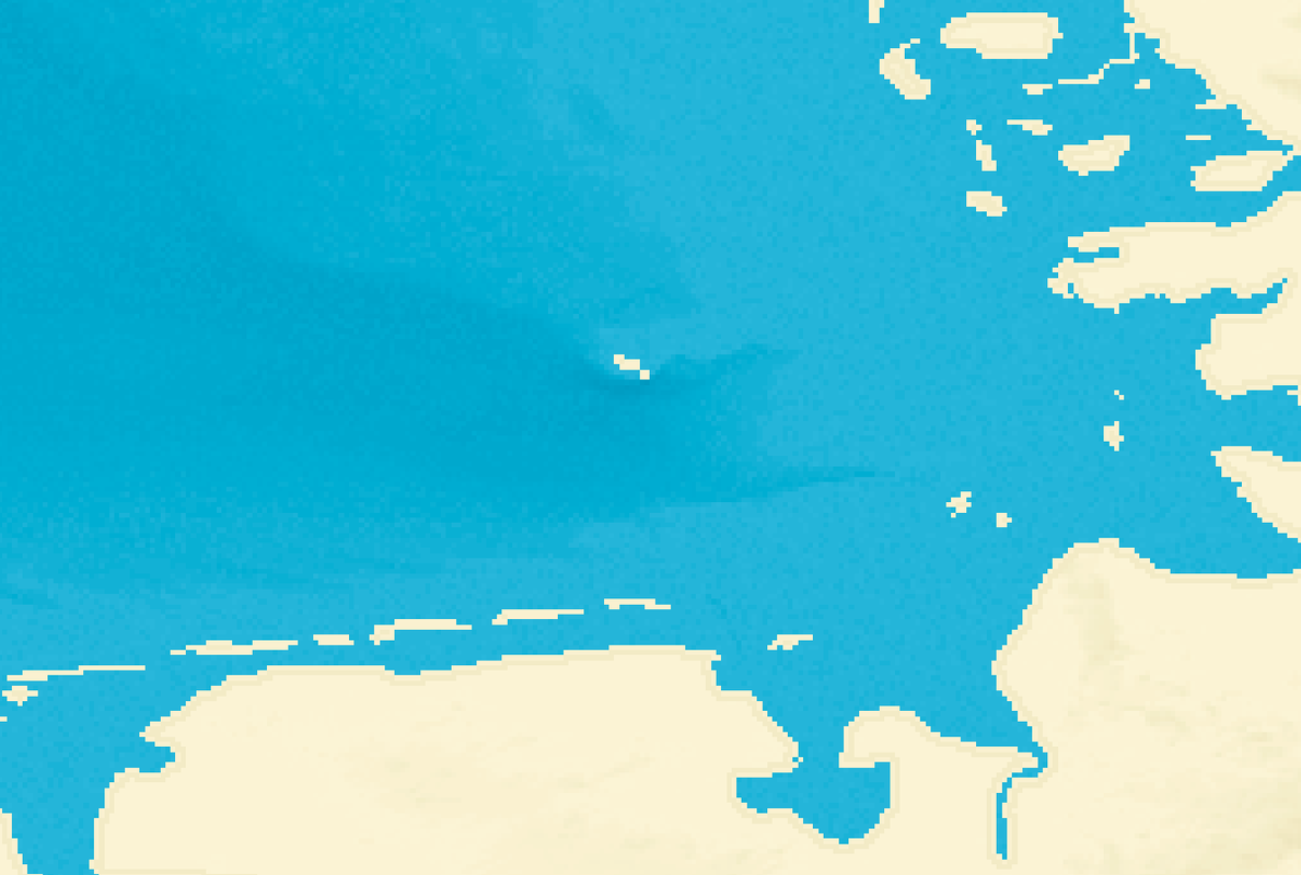 Wilhelmshaffen in SH4: 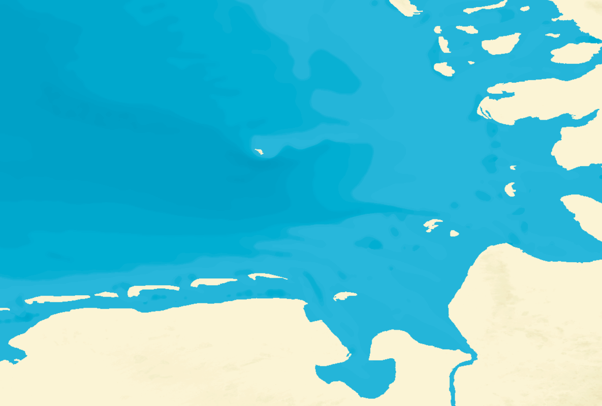 Wilhelmshaffen in SH4: 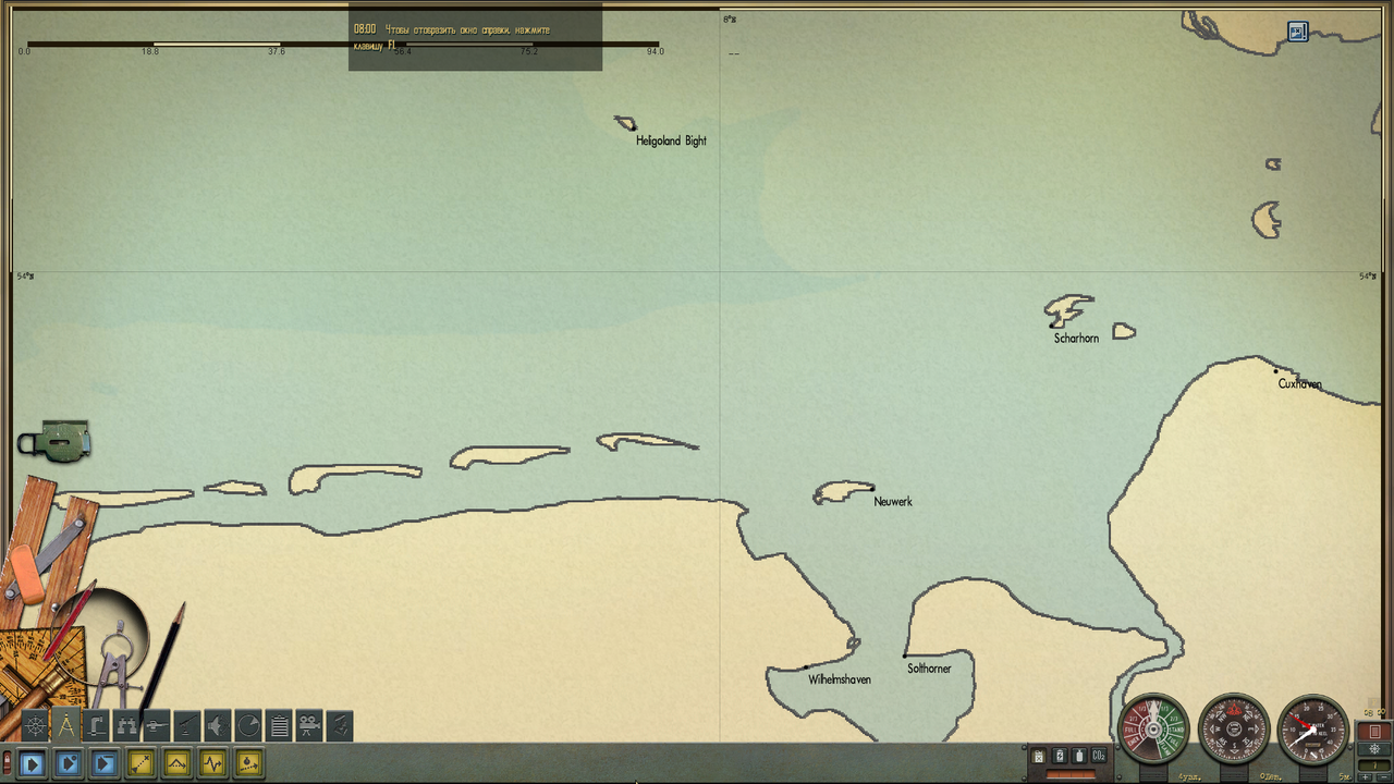 -------------------------------------------------- ----------------------------------------- Unfortunately, the filter in the Navigation map of the game does not show us much. Still, I impose on the map texture in Photoshop, "Median" filter. I lose a bit of depth detail, but this is a necessary measure to ensure that the isolines of the depths on the game map look smooth. If a not to do this, the result is a map in which there are many square depressions and pits one pixel in size. Last edited by astvitaliy1982; 04-28-22 at 03:17 AM. |
|
|
|
|
04-28-22, 02:54 AM
|
#66 |
|
中国水兵
Join Date: Jun 2019
Posts: 278
Downloads: 558
Uploads: 0
|
P. S. I will not replace the fjords of Norway. I'll leave what was.
|
|
|
|
|
04-28-22, 02:49 PM
|
#67 | |
|
GLOBAL MODDING TERRORIST
Join Date: Sep 2014
Posts: 5,655
Downloads: 137
Uploads: 0
|
Quote:
1. It will ask for 2 RAW files to compare. 2. It will ask the direction of 1st RAW file to check. N, S, E, or W. 3. It will then compare the border areas of both files. If N is selected for RAW 1, The Southern border of RAW 2 will be scanned. And so on for given directions. |
|
|
|
|
|
04-28-22, 02:56 PM
|
#68 |
|
CTD - it's not just a job
Join Date: May 2016
Location: One hour from Music City USA!
Posts: 10,106
Downloads: 451
Uploads: 2
|
That sounds very sensible! Paint me in as a guinea pig!

__________________
"...and bollocks to the naysayers" - Jimbuna |
|
|
|
|
04-28-22, 03:00 PM
|
#69 |
|
GLOBAL MODDING TERRORIST
Join Date: Sep 2014
Posts: 5,655
Downloads: 137
Uploads: 0
|
I'll probably allow you to do an auto 'fix' if pixels don't match.

|
|
|
|
|
04-28-22, 03:07 PM
|
#70 |
|
CTD - it's not just a job
Join Date: May 2016
Location: One hour from Music City USA!
Posts: 10,106
Downloads: 451
Uploads: 2
|
That would be very nice also!
__________________
"...and bollocks to the naysayers" - Jimbuna |
|
|
|
|
04-29-22, 02:50 AM
|
#71 |
|
中国水兵
Join Date: Jun 2019
Posts: 278
Downloads: 558
Uploads: 0
|
Можно ли создать скрипт который сможет открывать не один квадрат а девять, обьединенных в один квадрат?
|
|
|
|
|
04-29-22, 09:11 AM
|
#72 | |
|
GLOBAL MODDING TERRORIST
Join Date: Sep 2014
Posts: 5,655
Downloads: 137
Uploads: 0
|
Quote:
You'd end up with a RAW file 1791 X 1791 You might be able to write a Script for Photoshop that would do the same thing. Never wrote any Photoshop scripts so just guessing about that. |
|
|
|
|
|
04-29-22, 09:36 AM
|
#73 |
|
中国水兵
Join Date: Jun 2019
Posts: 278
Downloads: 558
Uploads: 0
|
If you can do that, that would be really cool. I would say that it would be a completely new level of relief processing. It would speed up the process of importing squares into the game by nine times. With such a script, it would be possible to create not only the Baltic and the North Sea, but the entire Mediterranean, the coast of America, Newfoundland and anything ...)
Depths and elevations are easy to create. This is done in a couple of days. But transferring this data to the game takes a very long time...((( I use "script" in Photoshop. I recorded a history of my actions and use it to import each file into the game. This speeds up my work by 15 seconds.))) |
|
|
|
|
04-29-22, 09:45 AM
|
#74 |
|
GLOBAL MODDING TERRORIST
Join Date: Sep 2014
Posts: 5,655
Downloads: 137
Uploads: 0
|
One would have to reverse the blending to create standard 601 x 601 RAW files then pack them into ZHF files.
|
|
|
|
|
04-29-22, 01:55 PM
|
#75 |
|
CTD - it's not just a job
Join Date: May 2016
Location: One hour from Music City USA!
Posts: 10,106
Downloads: 451
Uploads: 2
|
That is an interesting idea astvitaliy1982... it would allow easier editing across the "border" areas of adjacent 601x601 tiles...
Would it be easier to do the combining / re-interpolating the "borders" area of the nine tiles (almost sounds like we're talking about Scotland and England), or just do the 601x601 edits and have a program to remember and / or match the adjacent "borders" settings between them?
__________________
"...and bollocks to the naysayers" - Jimbuna |
|
|
|
 |
|
|


 Linear Mode

