
|
|
SUBSIM: The Web's #1 resource for all submarine & naval simulations since 1997
|
SUBSIM: The Web's #1 resource for all submarine & naval simulations since 1997 |
|
|
 11-01-11, 09:38 AM
|
#1 |
|
Ace of the Deep
 Join Date: Jan 2002
Location: London, England
Posts: 1,144
Downloads: 54
Uploads: 0
|
Pisces thanks for your input which I found most interesting. If I understand you correctly, are you saying that the difference between Google Earth and the SH3 map is only 0.01%?
Forgive me if I have completely misunderstood what you were saying. Nemo
__________________
"I'm afraid there is no disguising the fact that King's obsession with the Pacific and the Battle of Washington cost us dear in the Battle of the Atlantic". Sir John Slessor GCB, DSO, MC, DL AOC-in-C Coastal Command RAF ___________________________________________ |

|

|
|
11-01-11, 12:36 PM
|
#2 | ||
|
Ensign
 Join Date: Mar 2011
Posts: 234
Downloads: 123
Uploads: 0
|
Quote:
Quote:
At least superficially, it looks like an "Equirectangular" projection so that lines of latitude and longitude are equally spaced. (not my images) 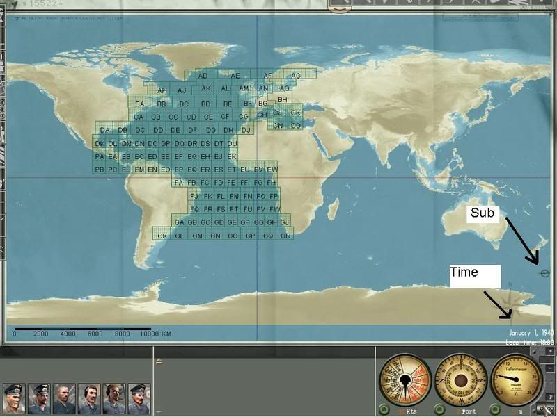 
__________________
Career: Feb. 13, 1942 "Cpt. Johny Goodwood" Porpoise class: USS Shark, SS-174 Patrols: 2 Victories: 1 Merchants (4519 GRT), 0 Warships (0 GRT), 0 Aircraft Sunk with all hands lost. |
||
|
|
|
|
11-01-11, 04:01 PM
|
#3 | ||||
|
Silent Hunter
  Join Date: Dec 2004
Location: AN9771
Posts: 4,904
Downloads: 304
Uploads: 0
|
Quote:
Quote:
When sailing near land you shouldn't be browsing Google Earth anyway. Quote:
Quote:
__________________
My site downloads: https://ricojansen.nl/downloads |
||||
|
|
|
|
11-01-11, 04:28 PM
|
#4 | |
|
Ensign
Join Date: Mar 2011
Posts: 234
Downloads: 123
Uploads: 0
|
Quote:
In SH, the degrees of longitude are always the same at 120 km. So a feature which is 55km long becomes stretched to 120 km long at 60 degrees latitude on the game map. It would be nice if the SHIII world was actually round (like in the Microsoft flight sims). It would be a little more complicated to transfer a dot on the globe onto the flat map, but it would be well worth it: real distances and continent shapes/sizes and the possibility for real navigating using the sun and stars (with sun, moon, and planetary positions accurate for 1939-1945).
__________________
Career: Feb. 13, 1942 "Cpt. Johny Goodwood" Porpoise class: USS Shark, SS-174 Patrols: 2 Victories: 1 Merchants (4519 GRT), 0 Warships (0 GRT), 0 Aircraft Sunk with all hands lost. |
|
|
|
|
|
11-01-11, 06:36 PM
|
#5 | |
|
Silent Hunter
Join Date: Dec 2004
Location: AN9771
Posts: 4,904
Downloads: 304
Uploads: 0
|
Quote:
But I guess I'm not the most eloquent these days.
__________________
My site downloads: https://ricojansen.nl/downloads |
|
|
|
|
|
11-01-11, 10:29 PM
|
#6 |
|
Ensign
Join Date: Mar 2011
Posts: 234
Downloads: 123
Uploads: 0
|
Nah, maybe I'm just too tired. It's been a long week (and it only just started
 ) )
__________________
Career: Feb. 13, 1942 "Cpt. Johny Goodwood" Porpoise class: USS Shark, SS-174 Patrols: 2 Victories: 1 Merchants (4519 GRT), 0 Warships (0 GRT), 0 Aircraft Sunk with all hands lost. |
|
|
|
|
11-02-11, 02:54 AM
|
#7 |
|
Ace of the Deep
Join Date: Jan 2002
Location: London, England
Posts: 1,144
Downloads: 54
Uploads: 0
|
Thanks for all the replies.
Luno appears to have identified the type of map projection used by SH3 which is equirectangular  . This is reinforced by what Wiki has to say "In particular, the plate carrée has become a de-facto standard for computer applications that process global maps, because of the particularly simple relationship between the position of an image pixel on the map and its corresponding geographic location on Earth". . This is reinforced by what Wiki has to say "In particular, the plate carrée has become a de-facto standard for computer applications that process global maps, because of the particularly simple relationship between the position of an image pixel on the map and its corresponding geographic location on Earth".Nemo
__________________
"I'm afraid there is no disguising the fact that King's obsession with the Pacific and the Battle of Washington cost us dear in the Battle of the Atlantic". Sir John Slessor GCB, DSO, MC, DL AOC-in-C Coastal Command RAF ___________________________________________ |
|
|
|
 |
|
|


 Hybrid Mode
