
|
|
SUBSIM: The Web's #1 resource for all submarine & naval simulations since 1997
|
SUBSIM: The Web's #1 resource for all submarine & naval simulations since 1997 |
|
|
 04-16-11, 07:08 AM
|
#1 | |
|
Loader
 Join Date: Apr 2010
Location: Italy
Posts: 85
Downloads: 17
Uploads: 0
|
If you'll agree, next week I can upload the HQ of this map: http://www.kartengruppe.it/immagini/subsim.jpg
As it's related to a big area of Pacific ocean, I think you'll may use for yours games Pino Quote:
|
|

|

|
|
04-16-11, 08:06 PM
|
#2 | |
|
中国水兵
 Join Date: Dec 2010
Posts: 278
Downloads: 91
Uploads: 0
|
Quote:
|
|
|
|
|
|
04-18-11, 09:09 AM
|
#4 |
|
Loader
Join Date: Apr 2010
Location: Italy
Posts: 85
Downloads: 17
Uploads: 0
|
Nachrichten für Seefahrer (Notices to Mariners) ... ...
On mediafire I've added a new kriegsmarine map of Pacific Ocean Here the preview: 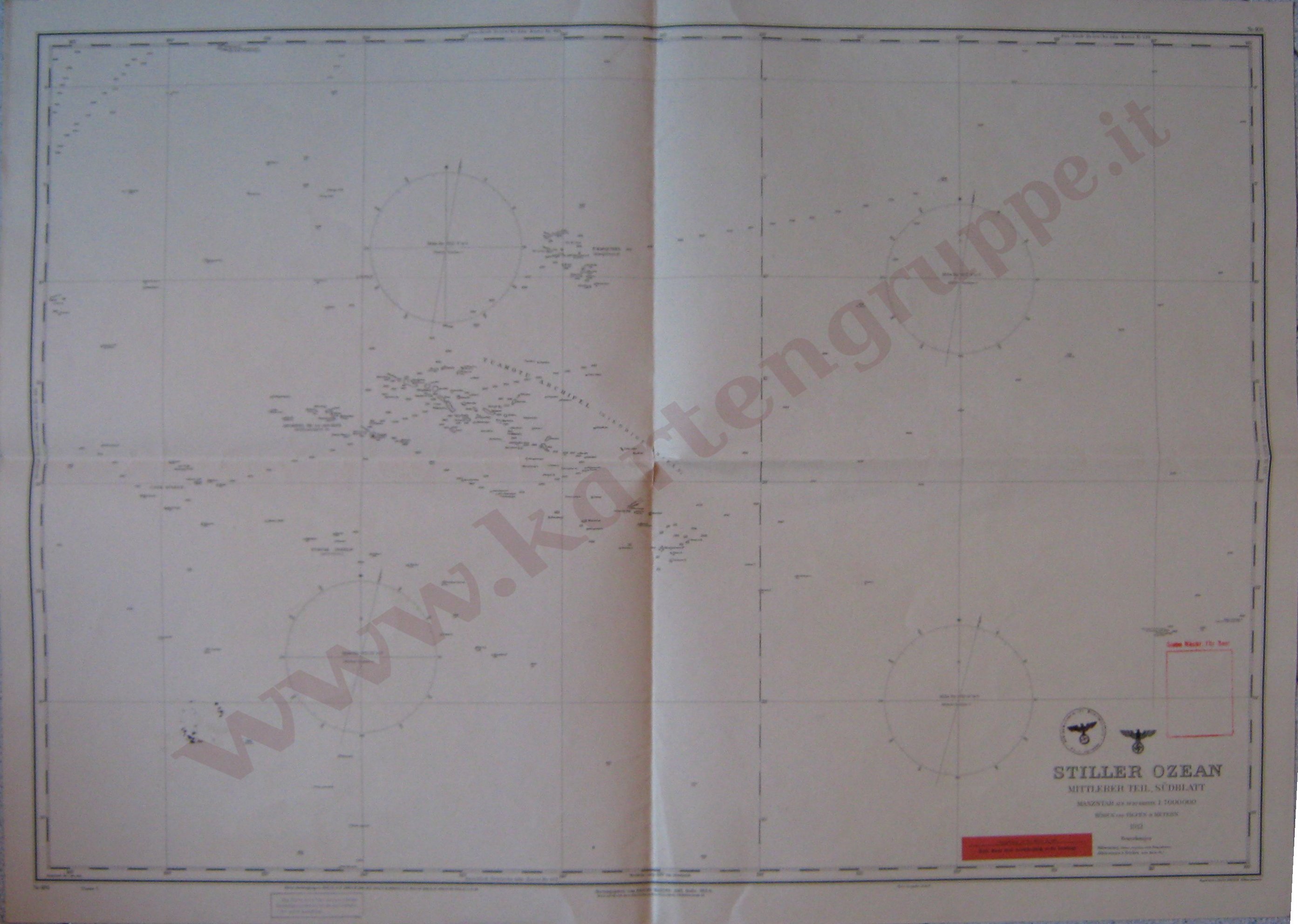 STILLER OZEAN - Mittlerer Teil, Sudblatt 1:7.000.000, Reichs-Marine-Amt, 1941 (su modello del 1913), Klasse 7, 98,5 x 70 cm Note: Mappa con timbro tondo "Kriegsmarinewerft Wilhelmhaven Kartengruppe" su entrambi i lati e timbro lineare "II.42." sul retro Altro: Risultando emessa nel 1941 riporta il simbolo della Kriegsmarine, nonostante vi sia riportata la dicitura Reichs-Marine-Amt. La mappa è in perfette condizioni di conservazione - - >> Download the file here << - - &, please, visit my site www.kartengruppe.it where I have stored the photo of my collection, about 100 Kriegsmarine original maps with fun Pino |
|
|
|
|
04-26-11, 07:53 AM
|
#5 |
|
Ocean Warrior
 Join Date: Jun 2005
Location: Canada, eh?
Posts: 2,537
Downloads: 129
Uploads: 0
|
I've been looking through the maps here and aside from a full sized Atlantic I can't find a map which covers the bulk of the North Sea.
Do either of the of the guys who posted maps here have any which are full sized but limited to the full North Sea and the eastern coastal areas of England? I found parts of the Channel, the Baltic, most of the Atlantic, the East Coast, I'm kind of heartbroken I can't find a dedicated North Sea map.  Any help? |
|
|
|
|
04-28-11, 10:01 AM
|
#6 | |
|
Loader
Join Date: Apr 2010
Location: Italy
Posts: 85
Downloads: 17
Uploads: 0
|
MQK
http://www.kartengruppe.it/immagini/okm/1864G-nb.jpg Deutsche Admiralitätskarten http://www.kartengruppe.it/index.php...d=36&Itemid=50 I have the scan of someone have fun Quote:
|
|
|
|
|
|
04-28-11, 02:05 PM
|
#7 |
|
中国水兵
Join Date: Dec 2010
Posts: 278
Downloads: 91
Uploads: 0
|
Would be nice to have a sharp scan of this area
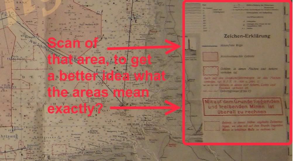 to get the exact details of this map "Karte minenfreirer wege Nr. 2". 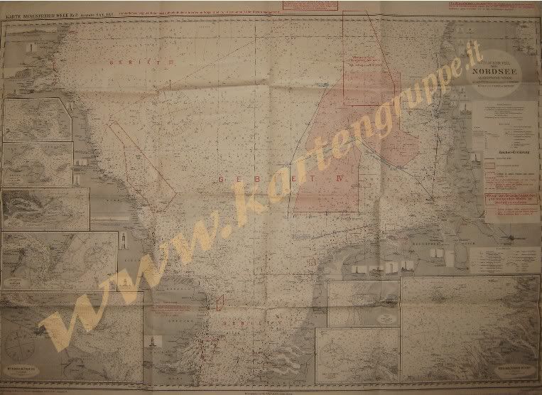 Or maybe the whole map "Karte minenfreie Wege Nr. 2", which would also be pretty good? |
|
|
|
 |
|
|


 Hybrid Mode
