
|
|
SUBSIM: The Web's #1 resource for all submarine & naval simulations since 1997
|
SUBSIM: The Web's #1 resource for all submarine & naval simulations since 1997 |
 09-05-08, 01:07 PM
|
#1 |
|
Ocean Warrior
 Join Date: Jan 2008
Posts: 2,909
Downloads: 77
Uploads: 11
|
EDIT: If anyone is looking at this and wondering where the maps are, it's because this is the WIP thread, there are two release threads:
http://www.subsim.com/radioroom/showthread.php?t=141812 for U.S. Subs http://www.subsim.com/radioroom/showthread.php?t=141977 for U-Boats, but works with U.S. Subs as well. Orginal message: Hello fellow subsimmers. I find the pastel shades of the standard map a bit hard to discern the gradients. Also there's no terrain height info with which to navigate by. I think nautical maps are generally only concerned with the depth of the ocean, not the height of the land, but with points of departure being used to plot departutre courses at the start of patrol, they must have used maps of the land that showed elevation as well as the sea depth? Anyway, is there any interest in a mod that changes the map's default colours? If so, what would you want them changed to? Here's the standard map: 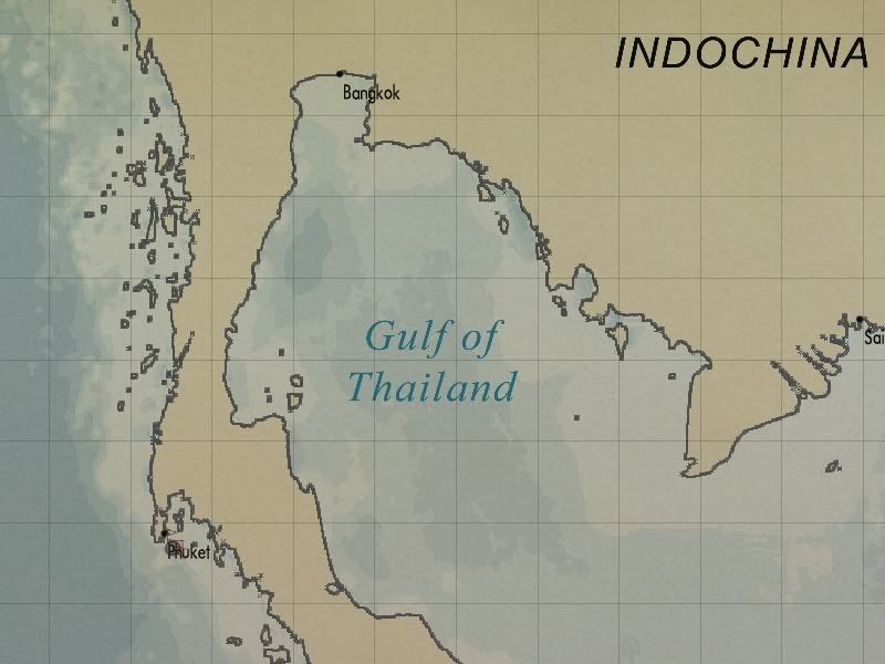 And here's what a new map could look like, note that height information has been added and the depth information is clearer:  Comments please!
__________________
-------------------------------- This space left intentionally blank. Last edited by Nisgeis; 09-21-08 at 02:08 PM. |

|

|
|
|


 Threaded Mode