
|
|
SUBSIM: The Web's #1 resource for all submarine & naval simulations since 1997
|
SUBSIM: The Web's #1 resource for all submarine & naval simulations since 1997 |
 06-28-08, 02:11 PM
|
#1 |
|
Ocean Warrior
 Join Date: Dec 2005
Location: Norway
Posts: 3,234
Downloads: 11
Uploads: 0
|
Google Earth - computerized log book
Seeing that I've used Google Earth a lot, I can't see why I haven't thought of this before. Google Earth, free map/globe/everything program, can be used to log your SHIII patrols, or in fact any kind of patrols or trips you undertake (I use it to log my kayaking trips
 )! )!Screenshots:The Comments field of placemarks house log entries. The Path tool sketches, roughly, the journey of the u-boat. 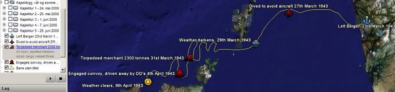 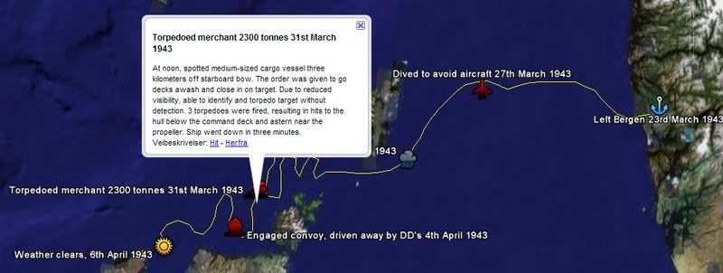 Experimenting with the Hexagon tool (to draw assigned patrol area, dark red transparent) and Image overlay tool (to post screenshots): 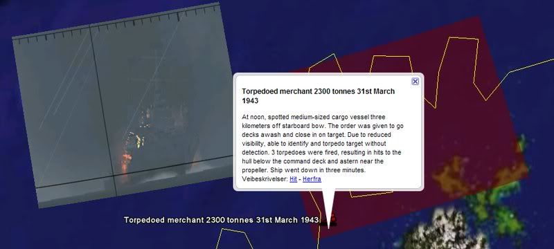 And if you've got problems remembering where everything happened, remember that you can always just grab a screenshot of the in-game chart and use the Image Overlay tool to put it into Google Earth! Though... do mind that it seems that the woefully inaccurate SHIII world is so out of scale that it's not possible to overlay a picture correctly without some part of it ending up being misrepresented. Or maybe I'm running into a problem related to how the Google Earth globe is round, while the SHIII world is flat? 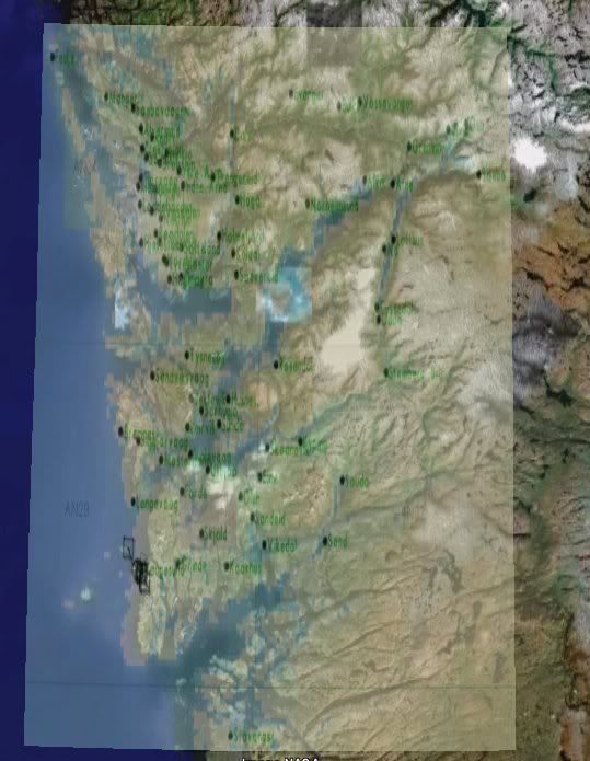 This could've been made to look a lot better if I'd given it more time, but it's just a sample I pieced together to show what you can do with the program. I feel that to those of you who actually write logs now and then, this could actually be quite a nice tool.
__________________
Last edited by Safe-Keeper; 06-28-08 at 02:22 PM. |

|

|
| Thread Tools | |
| Display Modes | |
|
|


 Threaded Mode