
|
|
SUBSIM: The Web's #1 resource for all submarine & naval simulations since 1997
|
SUBSIM: The Web's #1 resource for all submarine & naval simulations since 1997 |
 02-19-10, 09:24 PM
|
#1 | ||
|
Sonar Guy
 Join Date: Apr 2007
Posts: 381
Downloads: 281
Uploads: 0
|
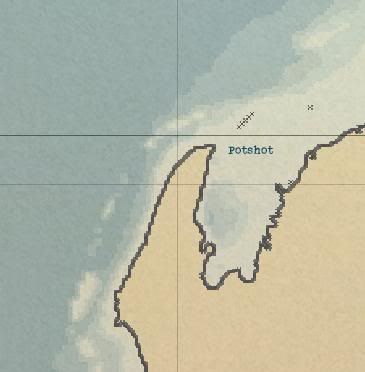
One of the little things about TMO I always liked was the fact that the submarine operating area code names were included on the in-game charts. A patrol was always more immersive if I knew I was conducting operations in Area BRIAR PATCH rather than just a set of coordinates. After finding a chart (available here) giving the area boundaries and submarine safety/bombing restriction lane waypoints for the southwest Pacific I decided to make this small mod to add these points to the TMO charts. I also included the correct labels for Exmouth Gulf (POTSHOT), Brisbane harbor (ADOBE), and the patrol area west of Manila Bay (WHITEWASH).
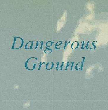
  In addition, I included a chart label for DANGEROUS GROUND - the collection of reefs and shoals located west of Palawan Island. DANGEROUS GROUND is mentioned in very nearly every book written about the submarine war in the Pacific and was avoided whenever possible. Quote:
Quote:
 Finally, I replaced the map on the control room chart table with an actual wartime US Navy chart. 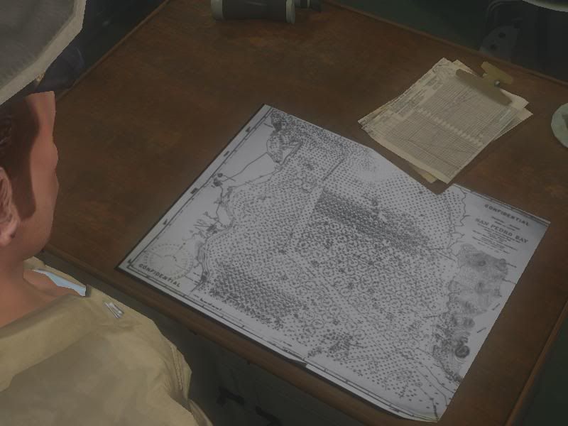 I hope you enjoy the mod. COMPATIBILITY: For use with TMO 1.9 either with or without RSRDC INSTALLATION: Enable in JSGME after all other mods DOWNLOAD: http://www.mediafire.com/?jddy2mmjtgn Last edited by virtualpender; 06-04-10 at 08:34 PM. |
||

|

|
| Thread Tools | |
| Display Modes | |
|
|


 Threaded Mode