SUBSIM Radio Room Forums


SUBSIM: The Web's #1 resource for all submarine & naval simulations since 1997

Go Back   SUBSIM Radio Room Forums > Silent Hunter 3 - 4 - 5 > Silent Hunter 4: Wolves of the Pacific
Forget password? Reset here

Reply
 
Thread Tools Display Modes
Old 02-18-08, 09:12 AM   #1
momo55
Frogman
 
Join Date: Mar 2007
Location: belgium
Posts: 297
Downloads: 125
Uploads: 0
Default A Zooooooomable world !

http://encarta.msn.com/encnet/featur...efid=701515479

Zoom in on the area you are with your sub and make a copy ...print..
Plot and mark etc......
Could become handy i think :hmm:

greetz all
__________________
Our greatest glory is not in never failing , but in rising up every time we fail .


momo55 is offline   Reply With Quote
Old 02-18-08, 09:24 AM   #2
Rockin Robbins
Navy Seal
 
Join Date: Mar 2007
Location: DeLand, FL
Posts: 8,900
Downloads: 135
Uploads: 52


Default Pretty cool!

I wonder if the ocean depths are modeled halfway correctly in the game? It would be really interesting to actually check out some soundings with an ocean chart.

Nice find!
Rockin Robbins is offline   Reply With Quote
Old 02-18-08, 09:44 AM   #3
Sailor Steve
Eternal Patrol
 
Sailor Steve's Avatar
 
Join Date: Nov 2002
Location: High in the mountains of Utah
Posts: 50,369
Downloads: 745
Uploads: 249


Default

That map is nice, but I think Google Earth is a lot better. You can not only zoom into street level, but it has both maps and satellite photos.
__________________
“Never do anything you can't take back.”
—Rocky Russo
Sailor Steve is offline   Reply With Quote
Old 02-18-08, 09:44 AM   #4
Torplexed
Let's Sink Sumptin' !
 
Torplexed's Avatar
 
Join Date: Dec 2001
Location: Seattle, WA
Posts: 5,823
Downloads: 43
Uploads: 0


Default

Quote:
Originally Posted by Rockin Robbins
I wonder if the ocean depths are modeled halfway correctly in the game? It would be really interesting to actually check out some soundings with an ocean chart.
Actually I think they're modeled too well. A lot of the Pacific was still relatively unexplored in the 1940s. But with the precise map in the game you have no excuse for running aground on an uncharted reef like a lot of skippers did.
__________________

--Mobilis in Mobili--
Torplexed is offline   Reply With Quote
Old 02-18-08, 02:13 PM   #5
seafarer
Commodore
 
Join Date: Feb 2005
Posts: 622
Downloads: 0
Uploads: 0
Default

The valor at sea web site refers to WWII US naval charts this way:

Quote:
The navigational charts of the Pacific Ocean used by the U.S. Navy during WWII were old, outdated and often badly inaccurate. ONI (the U.S. Office of Naval Intelligence) did however have fairly reliable information regarding the enemy's military and merchant shipping lanes.
We know that many of the charts of the Atlantic were miles out of whack with reality, and even much of it had not been properly sounded for depth surveys. I'd image the Asia-Pacific waters were largely effectively uncharted, at least for the near-shore areas.
__________________
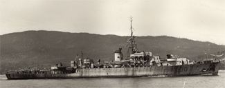
My Father's ship, HMCS Waskesiu (K330),
sank U257 on 02/24/1944
running SHIII-1.4 with GWX2.1 and SHIV-1.5 with TMO/RSRDC/PE3.3 under MS Vista Home Premium 32-bit SP1
ACER AMD Athlon 64x2 4800+, 4GB DDR2 RAM, 400GB SATA HD
Antec TruePower Trio 650watt PSU
BFG GeForce 8800GT/OC 512MB VRAM, Samsung 216BW widescreen (1680x1050) LCD
seafarer is offline   Reply With Quote
Old 02-18-08, 02:32 PM   #6
Torplexed
Let's Sink Sumptin' !
 
Torplexed's Avatar
 
Join Date: Dec 2001
Location: Seattle, WA
Posts: 5,823
Downloads: 43
Uploads: 0


Default

Quote:
Originally Posted by seafarer
The valor at sea web site refers to WWII US naval charts this way:

Quote:
The navigational charts of the Pacific Ocean used by the U.S. Navy during WWII were old, outdated and often badly inaccurate. ONI (the U.S. Office of Naval Intelligence) did however have fairly reliable information regarding the enemy's military and merchant shipping lanes.
We know that many of the charts of the Atlantic were miles out of whack with reality, and even much of it had not been properly sounded for depth surveys. I'd image the Asia-Pacific waters were largely effectively uncharted, at least for the near-shore areas.
Wow. I always figured the vast Pacific had some poorly charted areas, but the Atlantic too.:hmm:

It's interesting to note that the Solomons were so much fighting took place was virtually terra incognito prior to the war. Good maps and charts were hard to come by. Not surprisingly, it pretty quickly lapsed back into being a strategic backwater after the war.
__________________

--Mobilis in Mobili--
Torplexed is offline   Reply With Quote
Reply


Posting Rules
You may not post new threads
You may not post replies
You may not post attachments
You may not edit your posts

BB code is On
Smilies are On
[IMG] code is On
HTML code is Off

Forum Jump


All times are GMT -5. The time now is 02:29 AM.


Powered by vBulletin® Version 3.8.11
Copyright ©2000 - 2025, Jelsoft Enterprises Ltd.
Copyright © 1995- 2025 Subsim®
"Subsim" is a registered trademark, all rights reserved.