
|
|
SUBSIM: The Web's #1 resource for all submarine & naval simulations since 1997
|
SUBSIM: The Web's #1 resource for all submarine & naval simulations since 1997 |
 08-26-10, 08:36 PM
|
#121 |
|
Ace of the Deep
 Join Date: Dec 2004
Location: Valhalla: Silent Generation
Posts: 1,149
Downloads: 910
Uploads: 0
|
Here is something I need you to try:
1) Enter date/time data into Python. When it throws you automatically into Stellarium, exit the Stellarium program. 2) Enter Stellarium again via the Desktop shortcut. Execute the sh4.ssc script in the configuration focus box. 3) Let me know what happens. 4) Don't bother with the startup script, it has nothing to do with Python or SH4.
__________________
[SIGPIC][/SIGPIC] During times of universal deceit, telling the truth becomes a revolutionary act. ~ George Orwell |

|

|
|
08-26-10, 11:56 PM
|
#122 |
|
Ocean Warrior
 Join Date: Sep 2008
Location: Notify command we have entered the Grass Sea
Posts: 2,822
Downloads: 813
Uploads: 0
|
It worked a couple of times. Then it stopped working.
|
|
|
|
|
08-27-10, 06:26 AM
|
#123 |
|
Ace of the Deep
Join Date: Dec 2004
Location: Valhalla: Silent Generation
Posts: 1,149
Downloads: 910
Uploads: 0
|
I suspect that Stellarium may have gotten corrupted in the learning process. It may require an uninstall and new install. Start up your single mission in SH4, move your boat a ways (tc x512). Stop. Do a save game. Now, try the whole process again, Python plus Stellarium and see were Stellarium has you.
BUT, If that doesn't work... Trying the "process" using a single (training) mission is something I, personally, would not do. To give it a real test for ability to work, I suggest starting a new game/mission going into C:\Python26\Tools\Scripts\SH4toStellarium.ssc.py and changing the directory string embedded in the script: (C:\\Users\\bill\\Documents\\SH4\\data\\cfg\\SaveG ames\\0000000?\\SaveData.Map) <--------- Nota Bene: This may not be your exact directory string--I'm doing this from memory on my Mac. The "?" means to insert the exact game number. Don't forget to save after changing the string. Try it then. IF However, if it still doesn't work--do the unistall....new install of Stellarium.
__________________
[SIGPIC][/SIGPIC] During times of universal deceit, telling the truth becomes a revolutionary act. ~ George Orwell Last edited by don1reed; 08-27-10 at 07:26 AM. |
|
|
|
|
08-27-10, 08:55 AM
|
#124 |
|
Ace of the Deep
Join Date: Dec 2004
Location: Valhalla: Silent Generation
Posts: 1,149
Downloads: 910
Uploads: 0
|
I use the Python/Stellarium Navigation (PSN) method for both SH3 and SH4.
SH3 is Straight forward in that the saved games are placed in the CAREERS directory and the single missions are saved in the SINGLE MISSION directory. In SH4, I don't know if Career missions are separated from Single missions. (I've never saved single missions using either sh3/4) Are they thrown into the same pot? If so, a great amount of confusion will take place when developing your Python SH4toStellarium10.ssc.py script file for SH4. If you've chosen the incorrect "0000000?" game, Stellarium will not show any change in you geo coordinates as you progress during your cruise. This requires RFIR (Requires Further Investigative Research) Just finished checking my SH4. Started and saved a single mission and it's as I thought, everything saved is thrown into the same pot. the Player must be aware of which saved game he/she chooses when making changes in their SH4toStellarium20.ssc.ph script file. @I'm Going Down: In view of what I just discovered, I suggest you delete your current Single Mission and begin a new career and use the new "0000000?" game number in your SH4toStellarium10.ssc.py script file.
__________________
[SIGPIC][/SIGPIC] During times of universal deceit, telling the truth becomes a revolutionary act. ~ George Orwell Last edited by don1reed; 08-27-10 at 09:15 AM. |
|
|
|
|
08-27-10, 09:44 AM
|
#125 |
|
Ace of the Deep
Join Date: Dec 2004
Location: Valhalla: Silent Generation
Posts: 1,149
Downloads: 910
Uploads: 0
|
Here's a quick test you can perform:
I've opened and saved a copy of my SH4 SaveData.Map file: [Mark] PointsNb=0 [Ruler] PointsNb=0 [Range] PointsNb=4 Pt0=-1171460.38,6779873.00,0.00 Pt1=-1164979.36,6980244.54,0.00 Pt2=-436945.69,6721544.00,0.00 Pt3=-795561.72,5853088.20,0.00 [Angle] PointsNb=0 [Waypoint] PointsNb=8 Pt0=-1217501.54,6676092.09,-2.35...<----This is my current position [KGSelector] PointsNb=0 A quick check to determine my REAL Geo Coordinates is to divide each of those two quantities above by 120,000, i.e., -1217501.54 / 120000 = -10.1458 6676092.09 / 120000 = 55.6341 or, L55°38.0'N, λ10°08.7'W <-----This is my REAL (Lat-Long) position in the game. So, one can easily compare the coordinates of what one obtains via Sight Reduction (PSN) and where the cpu really has you. Just Zoom in on the F5 Chart screen in the game to where you can easily see one degree Lat/Long, hold down the CNTL key while right clicking your mouse. If you're between 5 and 10 nautical miles off, not to worry, you can see that far from the bridge (scope up). Any more than 10 nm, I'd redo the sight, check your time piece or GMT convertion, or redo your math. If the Altitude of Diamondhead at Waikiki is 761 ft. and the height of your eye on the bridge of your sub is 20 ft., you should be able to see the top of Diamondhead when you're about 32 nm radius away. So, it all depends on what your landfall is supposed to be that determines how accurate you need to be. Do you have to find a downed pilot in a fog? Then you damned well better measure twice before cutting once. Cheers,
__________________
[SIGPIC][/SIGPIC] During times of universal deceit, telling the truth becomes a revolutionary act. ~ George Orwell Last edited by don1reed; 08-27-10 at 12:23 PM. |
|
|
|
|
08-30-10, 09:17 AM
|
#126 |
|
Ace of the Deep
Join Date: Dec 2004
Location: Valhalla: Silent Generation
Posts: 1,149
Downloads: 910
Uploads: 0
|
Good News. "I'm Going Down" tells me his Python/Stellarium combo is finally working.
His saved games, for some unknown reason, weren't being saved where they were supposed to. When we last spoke, the only place the saved games were apparently going was into ...\SH4\data\cfg...etc., but that wasn't the case; instead, he advised me, they should have been saved into the ...\TMO\date\cfg...etc., directory. At any rate, all seems to be working now. Most times perseverance pays off, and in IGD's case it sure has. Nicely done. Now...for the hard part. It's back to school (we're never done with it). Always remember the 5 P's: Prior Planning Prevents Poor Performance. Fair winds, mate! 
__________________
[SIGPIC][/SIGPIC] During times of universal deceit, telling the truth becomes a revolutionary act. ~ George Orwell |
|
|
|
|
08-30-10, 09:50 AM
|
#127 |
|
Silent Hunter
  Join Date: Dec 2004
Location: AN9771
Posts: 4,904
Downloads: 304
Uploads: 0
|
And cloudless nights!
 Seems he used that MultiSH3/4 tool to get his profiles seperate for different installs. (the TMO-folder instead of SH4) Yeah, that could be usefull to have known that.
__________________
My site downloads: https://ricojansen.nl/downloads |
|
|
|
|
08-30-10, 10:53 AM
|
#128 |
|
Ace of the Deep
Join Date: Dec 2004
Location: Valhalla: Silent Generation
Posts: 1,149
Downloads: 910
Uploads: 0
|
Good afternoon, Pisces!
I've been meaning to ask...which process of sight reduction have you settled on? (H.O. pub 211 or something similar)
__________________
[SIGPIC][/SIGPIC] During times of universal deceit, telling the truth becomes a revolutionary act. ~ George Orwell |
|
|
|
|
08-30-10, 12:03 PM
|
#129 |
|
Silent Hunter
Join Date: Dec 2004
Location: AN9771
Posts: 4,904
Downloads: 304
Uploads: 0
|
I've intended to use the Ageton tables (H.O. 211) but haven't really dug into them yet. I very sporadically played SH(3) the past year. To busy with work to allow myself long-nighters. Sofar, I cheated mostly with the online almanac to do the number crunching.
__________________
My site downloads: https://ricojansen.nl/downloads |
|
|
|
|
08-30-10, 01:07 PM
|
#130 |
|
Navy Seal
 Join Date: Mar 2007
Location: DeLand, FL
Posts: 8,900
Downloads: 135
Uploads: 52


|
Thought folks might appreciate seeing some of the problem they have to deal with to make SH4 Celestial Navigation possible. I'm sure you think the sun rises in the morning and sets in the evening. A nice animation would show it ascending vertically or at a small angle up into the sky.
Except sometimes! Let's say your sub is sitting in Dutch Harbor on the morning of February 2, 1943. Let's say you had the time to sit on the bridge and watch the sun from 9:39 am until 4:51 pm. What do you think you would see? Well, reality is different. Using a decent astronomical and solar system simulator, Cartes du Ciel, with the sky artificially turned dark in spite of the sun being up so you can see the motion of the entire sky, here is what you would encounter. First of all, the sun follows a path mostly across the sky, moving from left to right as you face south. Yes, it came from below the horizon and exits below the horizon at sunset but mostly it flies across the sky from sunrise to sunset, never reaching higher than 20º above the horizon! As a bonus for this day, our Creator tossed in a free total solar eclipse, with maximum eclipse at 1:57 pm. I apologize for the small size of the sun, that is the size it really is. And although the moon flies formation across the sky all day with the sun, you can't see it! When the moon is that close to the sun it is a new moon and we're looking strictly at the unilluminated half, which is black. The moon only becomes "visible" during the eclipse, as a dark disk hiding the sun. I don't even want to tell you what the sky does in Dutch Harbor when you face north at night! Enough insanity for one day. 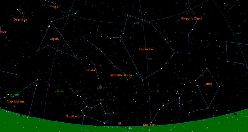
__________________
Sub Skipper's Bag of Tricks, Slightly Subnuclear Mk 14 & Cutie, Slightly Subnuclear Deck Gun, EZPlot 2.0, TMOPlot, TMOKeys, SH4CMS |
|
|
|
|
08-30-10, 01:09 PM
|
#131 |
|
Ace of the Deep
Join Date: Dec 2004
Location: Valhalla: Silent Generation
Posts: 1,149
Downloads: 910
Uploads: 0
|
@Pisces:
Nothing to be embarrassed about. I often have to be in the proper mood / frame of mind myself. Relying on modern conveniences too I find if I stay at it too long in the "game" format, I tend to get bored with the process. RL navigation has a lot more challenges and a lot more at stake which tends to keep you more focused. RL in general, in these times, has been doing that quite on it's own, hey? Cheers,
__________________
[SIGPIC][/SIGPIC] During times of universal deceit, telling the truth becomes a revolutionary act. ~ George Orwell Last edited by don1reed; 08-30-10 at 01:21 PM. |
|
|
|
|
08-30-10, 01:43 PM
|
#132 |
|
Ace of the Deep
Join Date: Dec 2004
Location: Valhalla: Silent Generation
Posts: 1,149
Downloads: 910
Uploads: 0
|
@Rockin Robbins:
Say, that's a neat Astro/solar sys sim. However, I don't see any navigational difficulty with 53°54.6'N x 166°31.9'W (Dutch Harbor) anymore than I would with 59°32.5'N x 001°37.3'W (Fair Isle, Scotland, UK) in the Orkney-Shetland gap. I've not sailed the North Pacific, but have been in the North Sea. I can imagine it has it quirks, hey?
__________________
[SIGPIC][/SIGPIC] During times of universal deceit, telling the truth becomes a revolutionary act. ~ George Orwell |
|
|
|
|
08-30-10, 02:51 PM
|
#133 |
|
Ocean Warrior
Join Date: Sep 2008
Location: Notify command we have entered the Grass Sea
Posts: 2,822
Downloads: 813
Uploads: 0
|
I looked at the program you use. I could not figure out the whistles and bells. Is there a tutorial on how to use it?
|
|
|
|
|
10-02-10, 10:10 AM
|
#134 |
|
Ace of the Deep
Join Date: Dec 2004
Location: Valhalla: Silent Generation
Posts: 1,149
Downloads: 910
Uploads: 0
|
I've been using these plotting sheets to find the one which can be used most easily with SH3 and SH4. The 4 pics at the bottom are all usable in RL; but the easiest to use in the "games" and most conforms with the F5 chart are the first two, immediately below. It requires that you use the center horizontal line as the Nearest Latitudinal parallel to your in-game position.
Latitude is obtained by drawing a line from point "A" in the lower-left corner to the nearest vertical line to the right. Now you draw short lines, one above and one below to designate the whole degrees above and below your present whole latitude. Individual minutes of latitude are obtained by placing one point of a pair of dividers at point A and the other point along the diagonal, drawn in, line. Longitude is represented by the vertical lines placed every two minutes apart. These longitudinal lines are always equidistant. I've shown two examples here:   These Plotting Sheets all work and are free to copy and use.  This is for close in work near shore. Small scale.  This is used for normal use at sea in open water.  This is the form where the longitude stays the same, but the latitude varies.  This form is from the US Coast Guard, dated 1941. Cheers,
__________________
[SIGPIC][/SIGPIC] During times of universal deceit, telling the truth becomes a revolutionary act. ~ George Orwell Last edited by don1reed; 10-02-10 at 10:24 AM. |
|
|
|
|
10-02-10, 11:10 AM
|
#135 |
|
Silent Hunter
Join Date: Dec 2004
Location: AN9771
Posts: 4,904
Downloads: 304
Uploads: 0
|
Nice charts! BTW, it's Schiermonnikoog, not Schiermoonikoog.
__________________
My site downloads: https://ricojansen.nl/downloads |
|
|
|
 |
|
|


 Linear Mode

