
|
|
SUBSIM: The Web's #1 resource for all submarine & naval simulations since 1997
|
SUBSIM: The Web's #1 resource for all submarine & naval simulations since 1997 |
 12-21-10, 10:47 PM
|
#1 |
|
Ace of the deep .

Join Date: Jan 2006
Posts: 9,226
Downloads: 901
Uploads: 73
|
This is how i use real navigation
Install The latest New UI mod and Trevally Automated Scripts v0.6 The navigator will give you a mark on the navigation map every 2 hours . Make sure that your real navigation script time corresponds with the game time .  Use your compass to head in the direction you need to go . I want to head 120 degrees . To bring up the compass click on the red square in the heading bar . In another 2 hours the navigator will give you another plot on your navigation map .  Click on your compass to change direction . I use Church's Compass Dials Mod v2.2 so the compass expands in size when i mouse over it . 
Last edited by THE_MASK; 09-08-12 at 10:25 PM. |

|

|
|
12-21-10, 11:48 PM
|
#2 | |
|
Ocean Warrior
 Join Date: Aug 2007
Location: Montreal, Canada
Posts: 2,983
Downloads: 102
Uploads: 1
|
Hah good story
This in fact is the only reason I don't want to try RealNav. I don't think between getting Manual Targetting skills back and figuring out the sextant I'll enjoy playing 
__________________
Quote:

|
|
|
|
|
|
12-22-10, 12:56 AM
|
#3 |
|
Watch
 Join Date: Sep 2009
Posts: 20
Downloads: 30
Uploads: 0
|
What type of u-boat
|
|
|
|
|
12-22-10, 01:39 AM
|
#4 | |
|
Ocean Warrior
Join Date: Aug 2007
Location: Montreal, Canada
Posts: 2,983
Downloads: 102
Uploads: 1
|
Really?
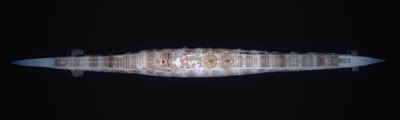
Sh5 = One U-boat class, Type 7. (VII) A through C41. Looking at the pic I'd say its a Type VII C
__________________
Quote:
|
|
|
|
|
|
12-22-10, 02:37 AM
|
#5 | |
|
Watch
Join Date: Sep 2009
Posts: 20
Downloads: 30
Uploads: 0
|
Quote:

|
|
|
|
|
|
12-22-10, 02:40 AM
|
#6 |
|
Ace of the deep .
Join Date: Jan 2006
Posts: 9,226
Downloads: 901
Uploads: 73
|
U-69 VIIC class 2 .
|
|
|
|
|
12-22-10, 12:29 PM
|
#7 | |
|
Engineer
 Join Date: Apr 2010
Location: San Francisco Bay Area
Posts: 215
Downloads: 36
Uploads: 0
|
Quote:
 You wanted realism and you got it! I'm impressed but too much of a whimp to try it myself. Happy hunting! 
__________________
My PC: ASUS P5VD2-VM mobo 3.2 GHz Pentium 4 4GB 667MHz RAM ATI Radeon HD 5750 1 GB Graphics Card Windows XP Pro, SP3, v. 5938 |
|
|
|
|
|
12-23-10, 06:50 AM
|
#8 |
|
中国水兵
 Join Date: Dec 2010
Posts: 278
Downloads: 91
Uploads: 0
|
Which mods do i have to install for the real navigation? Especially what do i have to do to get rid of my u-Boot position on the map?
|
|
|
|
|
12-24-10, 05:15 AM
|
#9 | |
|
Seasoned Skipper
 Join Date: Aug 2010
Location: 49°44´N 129°40´E
Posts: 665
Downloads: 124
Uploads: 7
|
Quote:
NewUIs_TDC_5_8_0_ByTheDarkWraith NewUIs_TDC_5_8_0_Real_Navigation
__________________
Speed squadron is the speed of the slowest ship ... but only so long as on the trail of the squadron did not sit submarines ... 
|
|
|
|
|
|
12-24-10, 05:25 AM
|
#10 | |
|
Seasoned Skipper
Join Date: Aug 2010
Location: 49°44´N 129°40´E
Posts: 665
Downloads: 124
Uploads: 7
|
Quote:
I was the second trip away from this mod. I felt like a captain. I plotted relying on speed and course of the boat. All other calculations makes the navigator. I like things this way.  Of course, provided that with the navigator did not happen. Of course, provided that with the navigator did not happen.
__________________
Speed squadron is the speed of the slowest ship ... but only so long as on the trail of the squadron did not sit submarines ...
|
|
|
|
|
|
12-24-10, 07:45 PM
|
#11 | |
|
中国水兵
Join Date: Dec 2010
Posts: 278
Downloads: 91
Uploads: 0
|
Quote:
Another question concerning position-verification during real navigation: the SH5-map dont show any lighthouse-symbols. Is there a list of implemented lighthouses in the game maybe with position-data? |
|
|
|
|
|
12-25-10, 02:58 AM
|
#12 |
|
Weps
 Join Date: Apr 2007
Posts: 351
Downloads: 35
Uploads: 0
|
I think, more than any other potential feature, charted navigation aids such as lighthouses would boost the realism of maritime navigation beyond anything else available in a publicly available sim / game today. Not even Ship Simulator gives the user the tools needed to adequately simulate marine navigation. Not that this takes away anything from Ship Simulator. But that game's focus is on ship handling in harbor, not trans-oceanic navigation.
In the mean time, in many cases you can still navigate using edges of land. Just pick three visible points of land more than 10-15 degrees apart each other and take some true bearings. The point where the three lines cross is where your fix is. If you get a "cocked hat" (small triangle instead of a perfect point) then plot your position inside. I'd like to see if there is a way for SH to plot the ship's position within a circle of uncertainty of say 3-5 nm at an interval of something like every 24 hours at noon, or near sunrise and sunset, simulating the results of an astro fix taken by the ship's navigator. Obviously cloudy weather would make this feature seem a little unrealistic. Regardless this would force the skipper to DR his way around the ocean without having to do all the "extra stuff" required to get an astro fix. I'm the Captain. I don't need to use a sextant. But I do make decisions based on the best position information available. And don't forget, depth contours can also be useful wayfinding tools. Take a line of bearing and ping your depth. Then look at your chart to determine the most logical place where both coincide. Doesn't work everywhere. But some places have steeper contours than others.
__________________
|
|
|
|
|
12-25-10, 07:47 AM
|
#13 | |
|
Black Magic
 Join Date: Jun 2007
Posts: 11,962
Downloads: 147
Uploads: 5
|
Quote:
|
|
|
|
|
|
12-25-10, 08:37 AM
|
#14 |
|
Admirable Mike

Join Date: Mar 2004
Location: Canada
Posts: 1,338
Downloads: 421
Uploads: 0
|
This is great stuff. I was reading a forum discussion about the map scale and ruler inaccuracy.
Does this have any bearing with the Nav mod? I'm going to try it anyway, because you don't want to miss an opportunity for realism! Thank you Darkwraith.
__________________
Game Designer: Close The Atlantic - World War Three https://boardgamegeek.com/boardgame/...orld-war-three |
|
|
|
|
12-25-10, 09:03 AM
|
#15 |
|
Navy Seal
 Join Date: Apr 2007
Location: AN1536 (Orkney)
Posts: 5,451
Downloads: 166
Uploads: 28

|
The maps scale is ok. Its the scale marker at bottom left that is out.
The tools only read to the nearest 50m. |
|
|
|
 |
|
|


 Linear Mode

