
|
|
SUBSIM: The Web's #1 resource for all submarine & naval simulations since 1997
|
SUBSIM: The Web's #1 resource for all submarine & naval simulations since 1997 |
 07-27-24, 02:09 AM
|
#1 |
|
Bosun
 Join Date: Sep 2021
Posts: 67
Downloads: 341
Uploads: 0
|
DOWNLOAD
Map n°1 = Nordsee : https://drive.google.com/file/d/11ah...usp=drive_link Map n°2 = Irland bis Island : https://drive.google.com/file/d/17wb...usp=drive_link Map n°3 = Biscaya Bucht : https://drive.google.com/file/d/1_L1...usp=drive_link Map n°4 = Westküste von Spanien und Portugal : https://drive.google.com/file/d/1PMc...usp=drive_link Map n°5 = Azoren : https://drive.google.com/file/d/1AoS...usp=drive_link Map n°6 = : en cours. Map n°7 = : en cours.  All current and future printable maps are, and will be, in A1 format. The A1 format : 84.10 cm in length and 59.40 cm in height. The maps themselves represent 11°14' of Longitude and 16°00' of Latitude, 1345km and 1920km. They are and will be exclusively all black and white. They are and will be all on the same scale. In the world of Silent Hunter 5 : 1°= 60' = 120km = 64.8 Nm. Everywhere. In the world of Silent Hunter 5 : We don't have magnetic declination  . Magnetic North = Geographic North.Everywhere. . Magnetic North = Geographic North.Everywhere.(I think but I'm not sure, I think the maps are also suitable for Silent Hunter 3, I've never played SH3 so I don't know, but it seems to me that the SH5 and SH3 map are exactly the same. If any SH3 players come through here it would be good to let us know.) Map n°1 = Nordsee. From (50°58'N; 11°37'E) to (62°12'N; 4°23'W) in game. Full map n°1 Nordsee overview 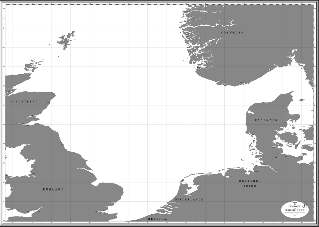 Wilhelmshaven, Helgoland and Kiel Kanal : 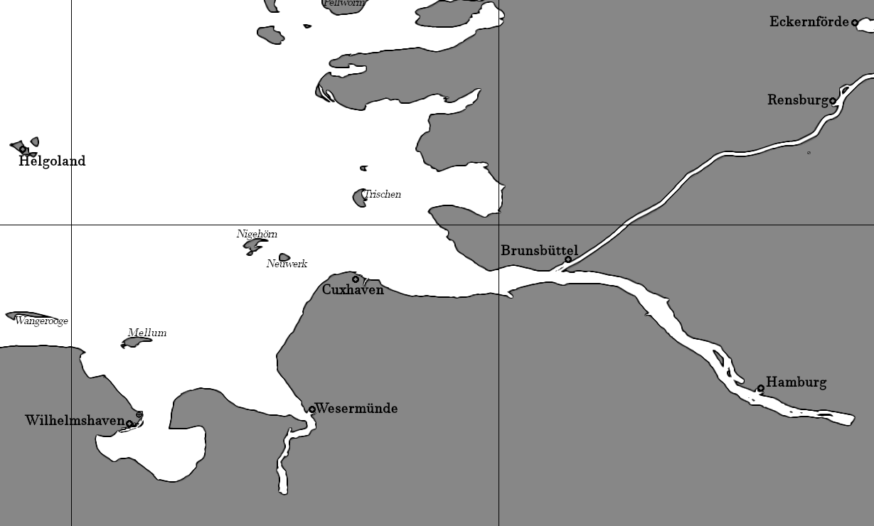 Bergen: 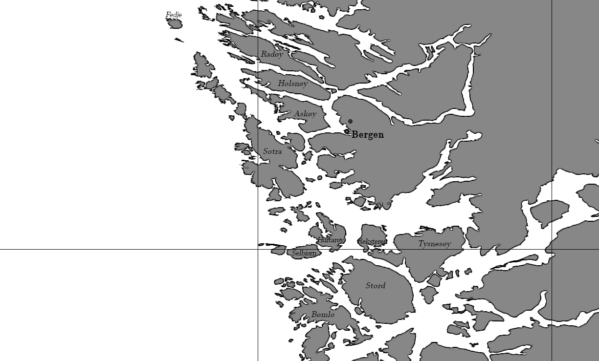 Map n°2 = Irland bis Island From (53°57'N; 4°18'W) to (65°11'N; 20°17'W) in game. Full map n°2 Irland bis Island overview: 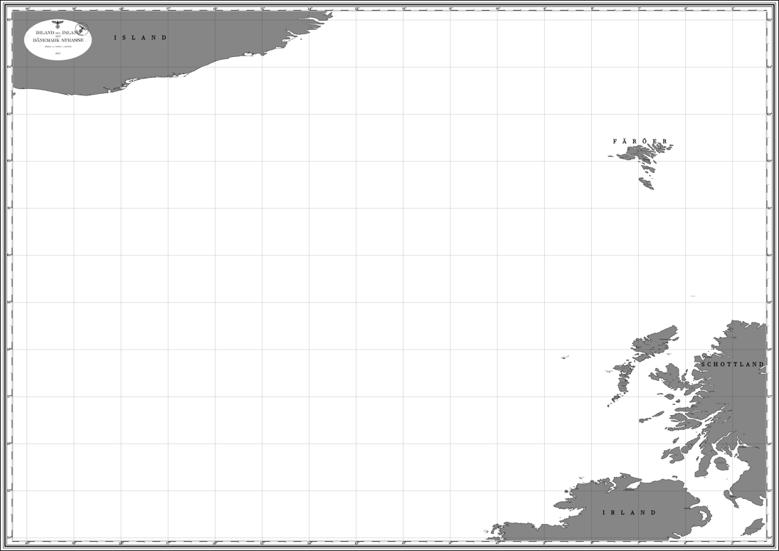 North Rona: 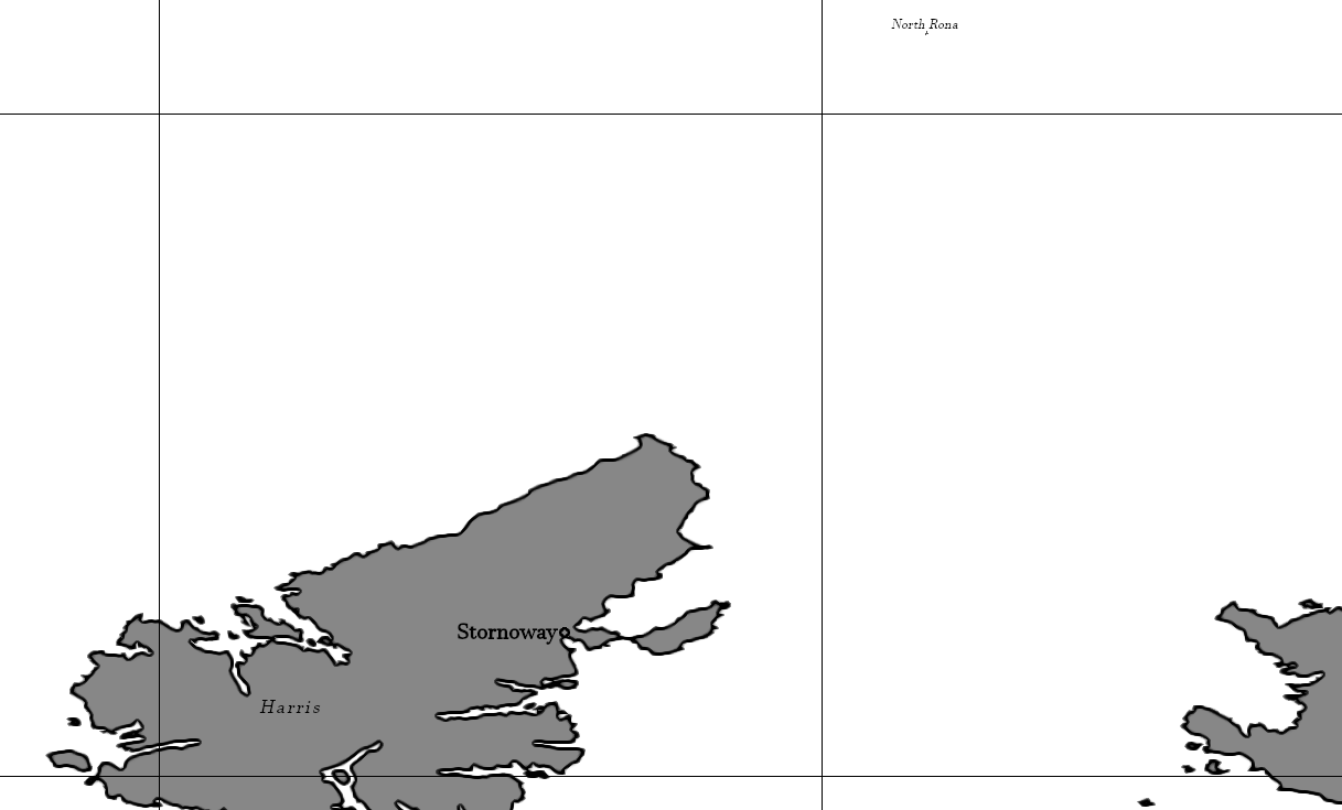 Faeroe Islands: 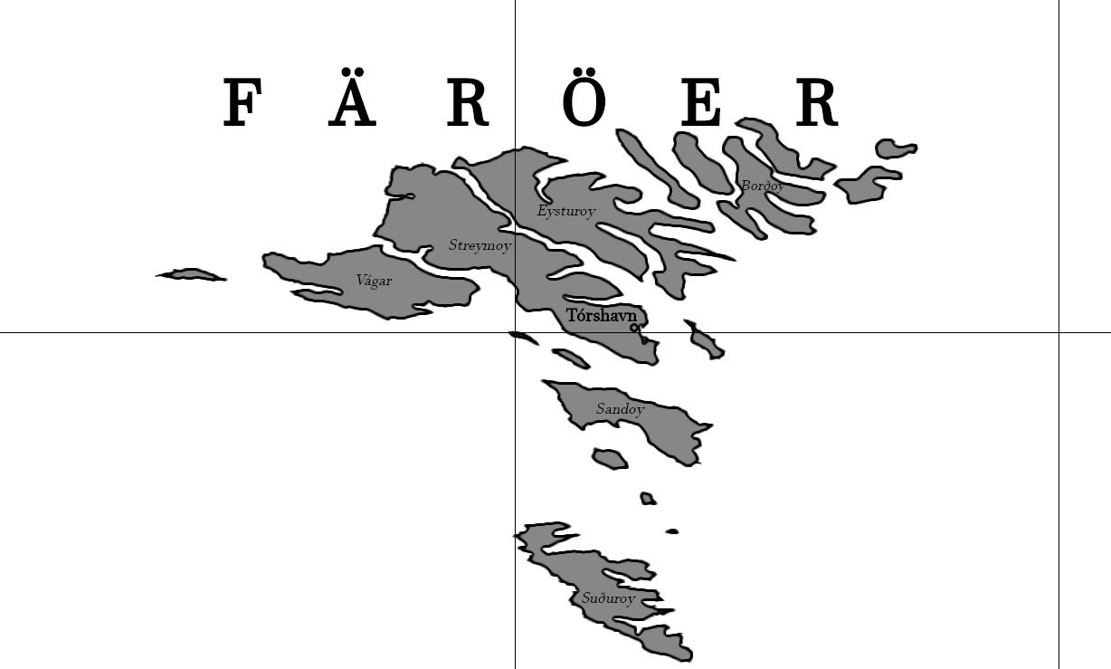 Map n°3 = Biscaya Bucht From (42°59'N; 0°32'W) to (54°13'N; 16°31'W) in game. Full map n°3 Biscaya Bucht overview: 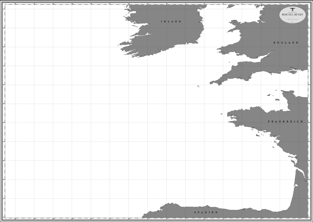 Brest and Lorient: 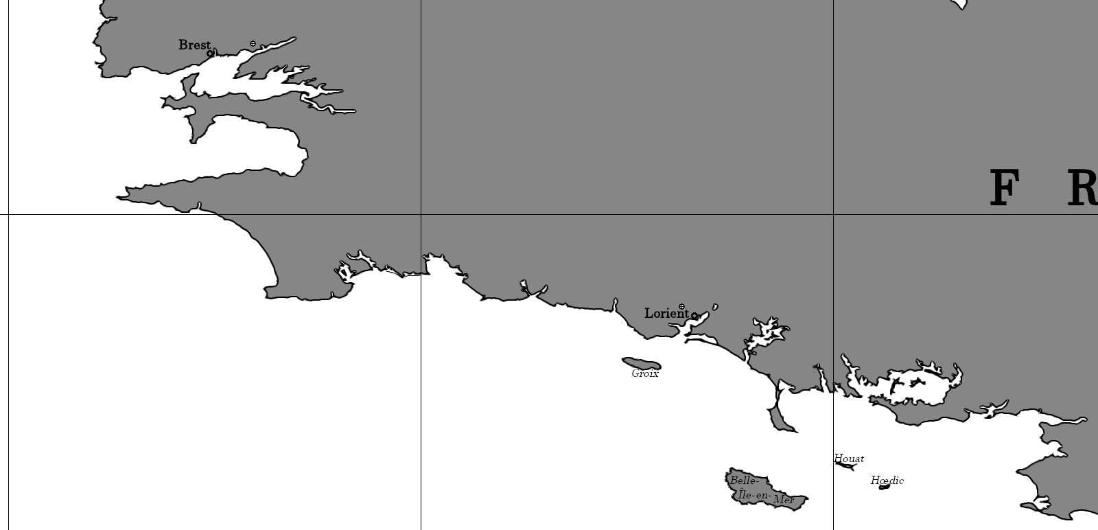 Ferrol: 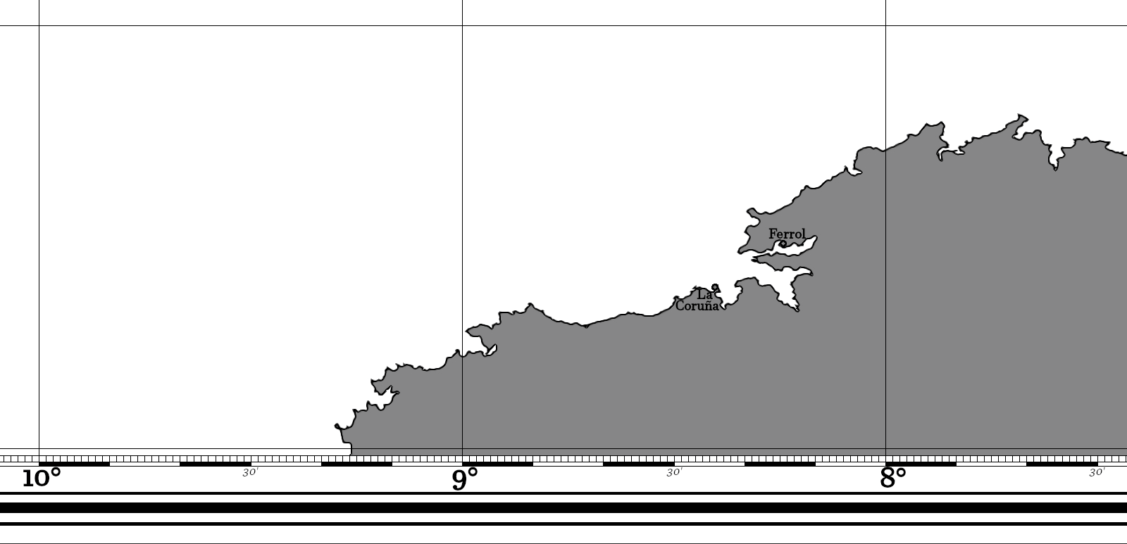 Map n°4 = Westküste von Spanien und Portugal. From (31°49'N; 5°16'W) to (43°03'N; 21°16'W) in game. Full map n°4 Westküste von Spanien und Portugal overview: 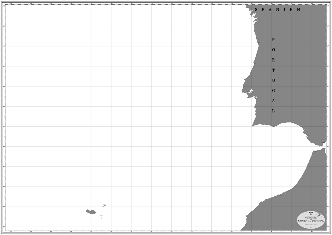 Gibraltar: 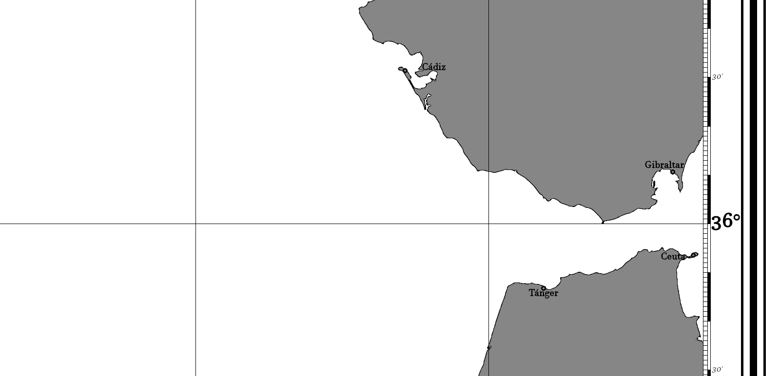 The Madeira Archipelago: 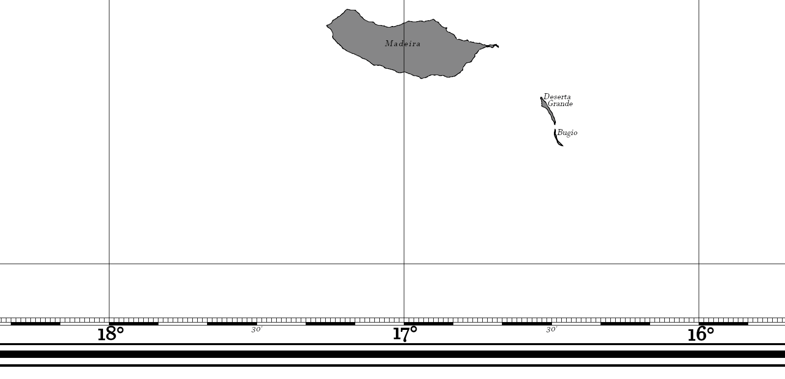 Map n°5 = Azoren. From (31°49'N; 27°14'W) to (43°03'N; 37°14'W) in game. Full map n°5 Azoren overview: 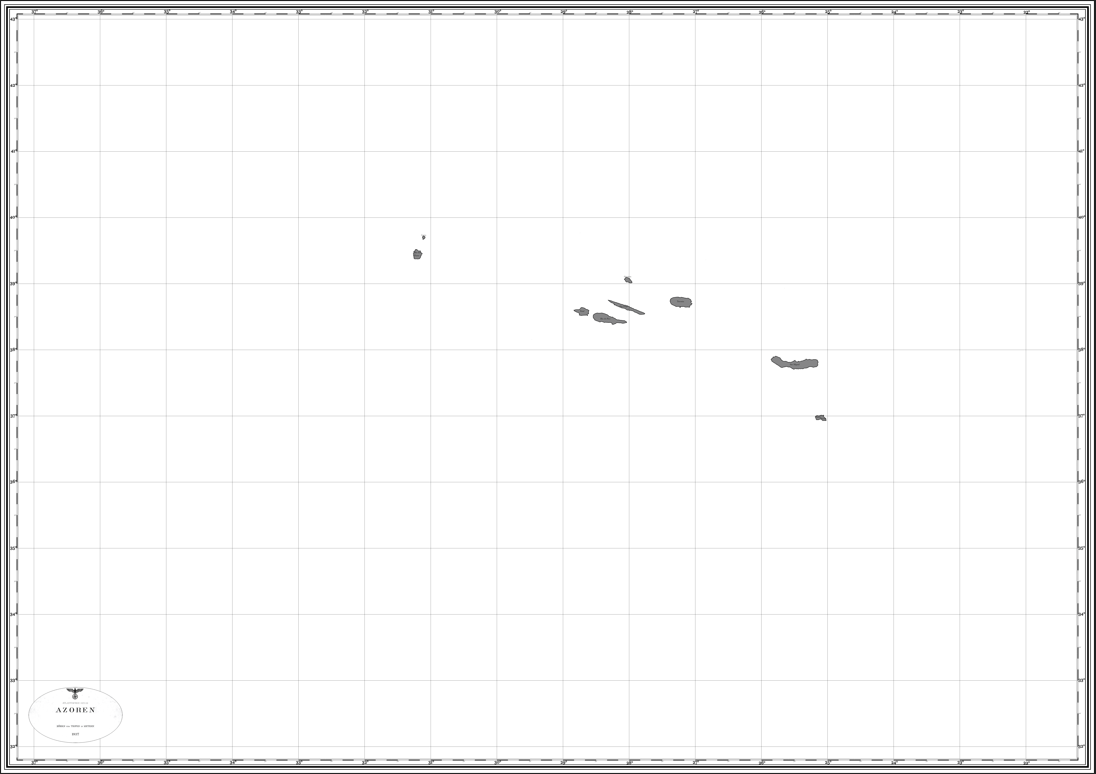 Location overviews of all maps: 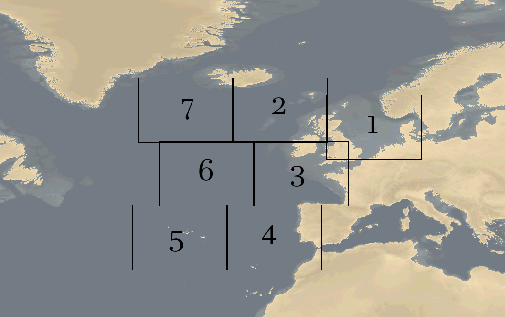 For those who want to understand Plotting with Triangles, it's here (in English) = Last edited by Dönitz78; 07-29-24 at 05:02 PM. |

|

|
|
07-27-24, 08:10 PM
|
#2 |
|
Argentinian Skipper

Join Date: Jul 2009
Location: Somewhere between Buenos Aires and the Bungo Suido
Posts: 5,226
Downloads: 3280
Uploads: 0


|
Many thanks!
 Fitzcarraldo 
__________________
 My subject is War, and the pity of War. The Poetry is in the pity - Wilfred Owen. |
|
|
|
|
07-30-24, 11:52 AM
|
#3 |
|
Kapitain Leutnant

Join Date: May 2010
Location: GlanerBrucke
Posts: 417
Downloads: 249
Uploads: 0
|
Thanks Donitz
__________________

|
|
|
|
 |
| Tags |
| map |
|
|


 Linear Mode

