|
|
SUBSIM: The Web's #1 resource for all submarine & naval simulations since 1997
 |
SUBSIM: The Web's #1 resource for all submarine & naval simulations since 1997 |
 01-09-06, 10:24 AM
|
#1 |
|
Ace of the Deep
 Join Date: Dec 2005
Location: Canada
Posts: 1,124
Downloads: 110
Uploads: 0
|
Is there a way other than pinging for depth to know depth under keel? Have looked in forum, but not finding anything on this.
|

|

|
 01-09-06, 10:32 AM
|
#2 |
|
Medic
 Join Date: Apr 2005
Location: Up the line in Canada eh
Posts: 162
Downloads: 0
Uploads: 0
|
click on navigator icon then click on reports then click on depth under keel icon
__________________
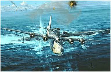
Sir! What was that noise?  Ironically the Shorts Sunderland is code letter U of No. 461 Squadron, and the submarine is U-461. |

|

|
 01-09-06, 10:39 AM
|
#3 | |
|
Ace of the Deep
 Join Date: Dec 2005
Location: Canada
Posts: 1,124
Downloads: 110
Uploads: 0
|
Quote:
|
|

|

|
 01-09-06, 10:49 AM
|
#4 |
|
Gunner
 Join Date: Jan 2002
Location: Georgia, USA
Posts: 99
Downloads: 12
Uploads: 0
|
I haven't found another way to check the depth. As in any combat situation, know your surroundings as well as possible. Check the depth often when your sound man indicates no contacts if you are planning on operating in that area.
__________________
John O There is No Finish Line, Keep Running! |

|

|
 01-09-06, 11:14 AM
|
#5 |
|
Electrician's Mate
 Join Date: Dec 2005
Location: oklahoma
Posts: 136
Downloads: 20
Uploads: 0
|
Usually I Stay in the dark blue water as much as possible. I'm workin on a Depth Average Chart according to the color of blue on the nav map. (i.e.) the lightest color blue on the nav map is usually pretty shallow. Dark Deep and everything else in between
Kerry |

|

|
 01-09-06, 12:01 PM
|
#6 |
|
Ace of the Deep
 Join Date: Jul 2005
Location: Suffolk, Virginia
Posts: 1,027
Downloads: 0
Uploads: 0
|
Would be nice if someone could mod the nav map.
|

|

|
 01-09-06, 12:09 PM
|
#7 |
|
Grey Wolf
 Join Date: Oct 2005
Location: Deep Waters
Posts: 871
Downloads: 31
Uploads: 0
|
If it's daytime, i usually use the observation scope to check the sea floor. you can usually get a good idea of how close to the bottom you are with that.
__________________
Guess I should change my sig since SH5 has an offline mode now |

|

|
 01-09-06, 12:14 PM
|
#8 |
|
Frogman
 Join Date: Feb 2005
Location: St louis
Posts: 304
Downloads: 18
Uploads: 0
|
Dive down till you hear a loud noise and your boat stops going down.
|

|

|
 01-09-06, 01:04 PM
|
#9 | |
|
Stowaway
Posts: n/a
Downloads:
Uploads:
|
Quote:
As others have said, take a lot of soundings early on, and try to get assigned to the open ocean, then you'll never have to worry about it. |
|

|
 01-09-06, 01:08 PM
|
#10 | ||
|
Grey Wolf
 Join Date: Oct 2005
Location: Deep Waters
Posts: 871
Downloads: 31
Uploads: 0
|
Quote:
Edit: Actually, I know I've been monkeying around with those files since I've installed IUB, so I don't know which mod it's using, but it is modded... :hmm:
__________________
Guess I should change my sig since SH5 has an offline mode now |
||

|

|
 01-10-06, 08:59 AM
|
#11 |
|
Ace of the Deep
 Join Date: Dec 2004
Location: Valhalla: Silent Generation
Posts: 1,149
Downloads: 910
Uploads: 0
|
__________________
[SIGPIC][/SIGPIC] During times of universal deceit, telling the truth becomes a revolutionary act. ~ George Orwell |

|

|
 01-10-06, 09:21 AM
|
#12 | |
|
Grey Wolf
 Join Date: Oct 2005
Location: Deep Waters
Posts: 871
Downloads: 31
Uploads: 0
|
Quote:
 But, who is Nomans? :rotfl:
__________________
Guess I should change my sig since SH5 has an offline mode now |
|

|

|
 01-10-06, 09:40 AM
|
#13 | |
|
Lieutenant
 Join Date: Mar 2005
Location: United Kingdom
Posts: 263
Downloads: 5
Uploads: 0
|
Quote:
In reality, charts don't tend to have too much depth data anyway, even today. The topography of the sea bed is just not that well known. (The USS San Francisco last year is the perfect example). In World War Two, accurate infomation avalable to U-boats would have been limited to the German Coast, with semi-acurate and vague data about the North Sea from about the world war one era. I'd be keen to see better charts like the rest of you, but i'd also like to keep it real.
__________________
...snorting / snorkelling after several years of silent running. |
|

|

|
 01-11-06, 08:40 AM
|
#14 |
|
Seaman
 Join Date: Feb 2004
Location: ohio
Posts: 32
Downloads: 0
Uploads: 0
|
its terrible to get caught in shallow water while in transit. I usally wait untill I know a destroyer has detected me if he is coming straight for you at top speed and pinging chances are he knows where your at already. your dead if you do nothing maybe dead if you crash dive run aground, so what do you have to lose. also check depth when being depth charged they cant hear your ping
|

|

|
 01-31-06, 05:22 PM
|
#15 | |
|
Lucky Jack
 |
Quote:
I did it once crashe dived killed two crew |
|

|

|
 |
|
|
