
|
|
SUBSIM: The Web's #1 resource for all submarine & naval simulations since 1997
|
SUBSIM: The Web's #1 resource for all submarine & naval simulations since 1997 |
 01-06-17, 07:10 AM
|
#1 |
|
Girt by Sea

Join Date: Mar 2015
Location: Red Route 1
Posts: 391
Downloads: 176
Uploads: 40

|
I finally got around to uploading some of my 'best' maps, guys. It's up on the 'Maps and Missions' section of the Downloads page.
Here are some maps I've made for Dangerous Waters. There are eighteen for you to enjoy. They are essentially 'blank' of triggers, scripts, ships and submarines, for you to make your own missions. All landmarks, features, and EEZ boundaries are marked as accurately as possible. Research Credits go to Wikipedia, Vector Globe Atlas, US policy releases, searates.com (for major ports) and marineregions.org (for EEZs), various news websites, and computer game manuals. All information was accessed from publically available sources. The maps are: Yemen, Kola Peninsula, East China Sea, South China Sea, Spratley Islands, Libya, Bougainville, Persian Gulf, The East Australian Exercise Area (EAXA), Cuba, Greenland-Iceland Gap, Iceland-UK Gap, North Atlantic, Syria, Timor Sea, Black Sea, Baltic Sea and Adriatic Sea. Disclaimer: Naturally, download at your own risk. I take no responsibility for any adverse effects to your computer by downloading these files. Feedback (and requests) welcome via the Subsim forums! Here is a pic of my EAXA Map - the East Australian Exercise Area - Australia's premier east-coast air and naval ranges 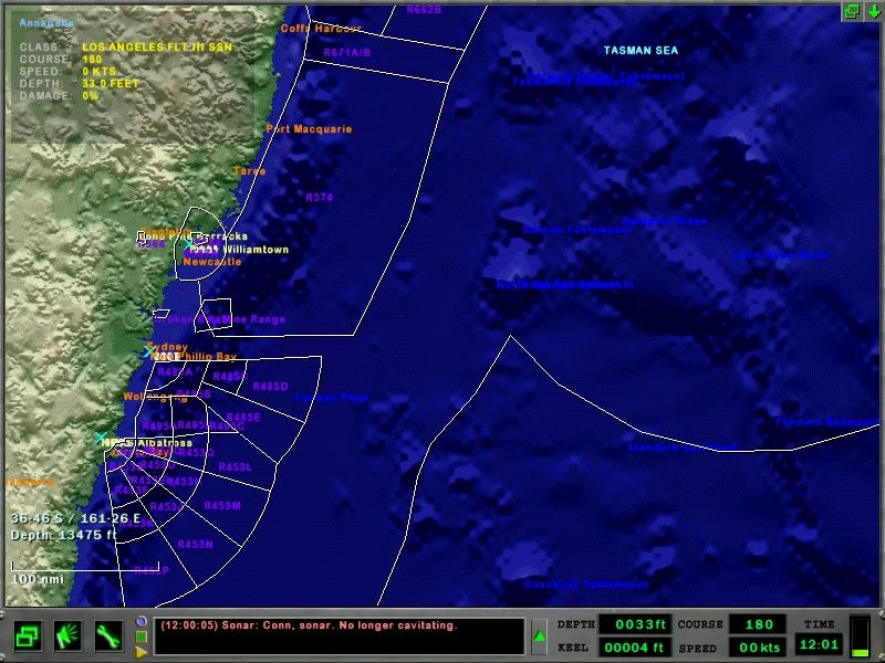 ...And here is my Persian Gulf Map 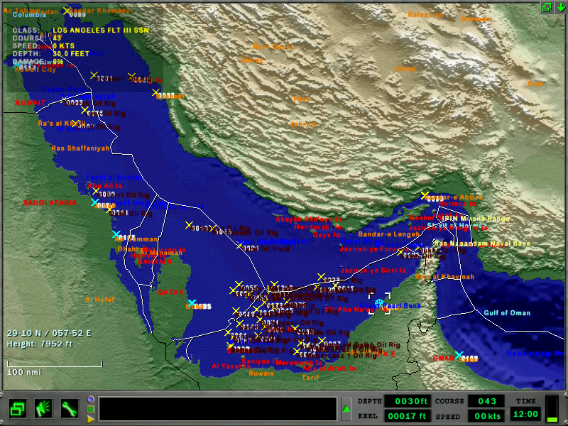 Enjoy! Last edited by Stewy1; 01-06-17 at 07:25 AM. |

|

|
| Thread Tools | Search this Thread |
| Display Modes | |
|
|


 Threaded Mode