
|
|
SUBSIM: The Web's #1 resource for all submarine & naval simulations since 1997
|
SUBSIM: The Web's #1 resource for all submarine & naval simulations since 1997 |
 04-07-24, 08:05 PM
|
#1 |
|
Girt by Sea

Join Date: Mar 2015
Location: Red Route 1
Posts: 363
Downloads: 131
Uploads: 34

|
https://www.subsim.com/radioroom/dow...o=file&id=6471
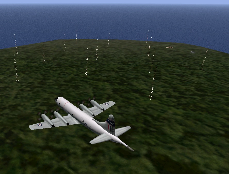 Here's my twenty-first instalment of maps I've made for Dangerous Waters. The three maps are: Two area of north-west Western Australia: * The North West Cape Training Area * Curtin Training Area And...inspired by Chazly recently playing 'African Bees Nest': * A 'more detailed' map of the Senegalese coast, including The Gambia. Map Information The North West Cape Training Area 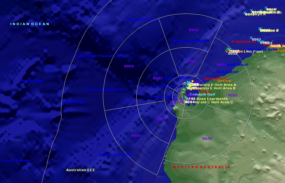 The North West Shelf, situated in the north-west of Western Australia, is Australia's largest resource development project. It involves the extraction of petroleum at offshore production platforms, onshore processing and export of liquefied natural gas. Located near the town of Exmouth, RAAF Base Learmonth is a joint use Royal Australian Air Force base and civil airport. RAAF Base Learmonth is one of the RAAF's three bare bases. It is maintained by the RAAF's 25 Squadron and a small caretaker staff during peacetime. The RAAF also operates the Learmonth Air Weapons Range. Naval Communication Station Harold E. Holt is a joint Australian and United States naval communication station. The station provides very low frequency (VLF) radio transmission to United States Navy, Royal Australian Navy and allied ships and submarines in the western Pacific Ocean and eastern Indian Ocean. Curtin Training Area 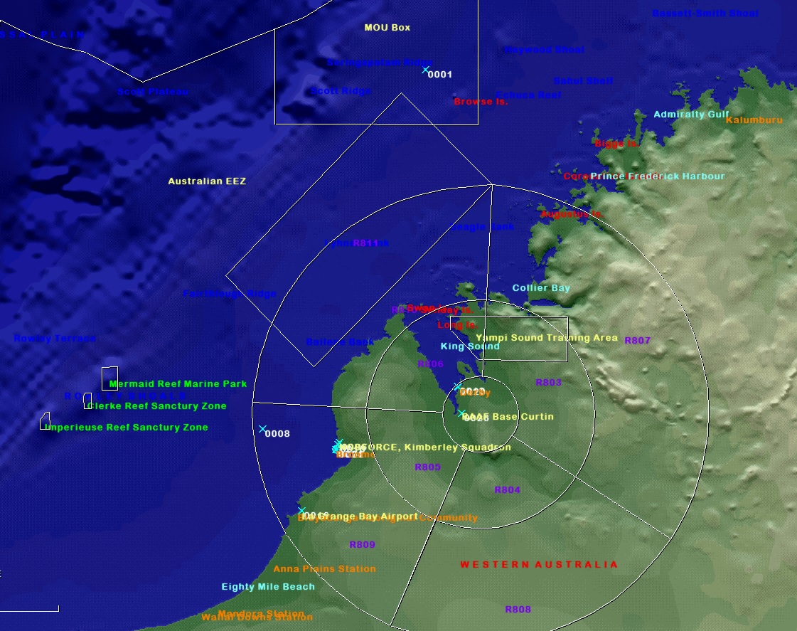 RAAF Curtin is a joint use Royal Australian Air Force military air base and civil airport located 19 nautical miles (35 km; 22 mi) southeast of the town of Derby, in Western Australia. As it is one of the RAAF's three bare bases, no RAAF units are permanently based at Curtin and it is maintained by a small caretaker staff during peacetime. The base is named in honour of former Prime Minister John Curtin. Derby, and the nearby port of Broome, are important patrol bases for the marine sanctuaries off the Kimberly coast, most importantly at the Rowley Shoals and Ashmore Reef. Illegal Indonesian fishing of fish, turtles, shark fin and sea cucumbers, known locally as Trepang, is a significant challenge for Australian naval customs officials. Since 1972, Australia has allowed 'traditional' (non-motorised) Indonesian fishing in a 50,000 square kilometre area known as 'MOU Box'. Senegalese Coast 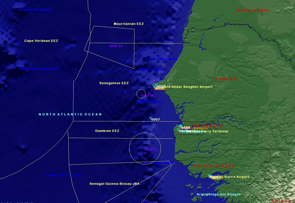 Senegal is bordered to the west by the North Atlantic Ocean. On land, the nation's longest border is with Mauritania to the north, an 813 km border along the Senegal River. To the east is the 419 km border with Mali. In the southeast is Guinea (330 km border) and to the south-southwest is Guinea-Bissau (338 km), both borders running along the Casamance River. Senegal is one of only a handful of countries to have a near-enclave within its borders—the small nation of the Gambia in the interior, which has a 740 km border with Senegal. The stock Dangerous Waters mission has the FFG docked at a sophisticated port along the Gambia River. In reality, this area is undeveloped, however the Albreda Ferry Terminal is ten miles closer to mouth and this is marked on the map, if you wanted to recreate the mission! Sources: Wikipedia They are essentially 'blank' of triggers, scripts, ships and submarines, for you to make your own missions. All landmarks, features, and EEZ boundaries are marked as accurately as possible. Research Credits go to Wikipedia, World Sea Ports (https://www.searates.com/maritime/), NGA Maritime Safety Navigational Warnings and marineegions.org (for EEZs) and various notices to mariners and news websites. The restricted airspace coordinates are from the FlightSim program, LittleNavMap. All information was accessed from publically available sources. 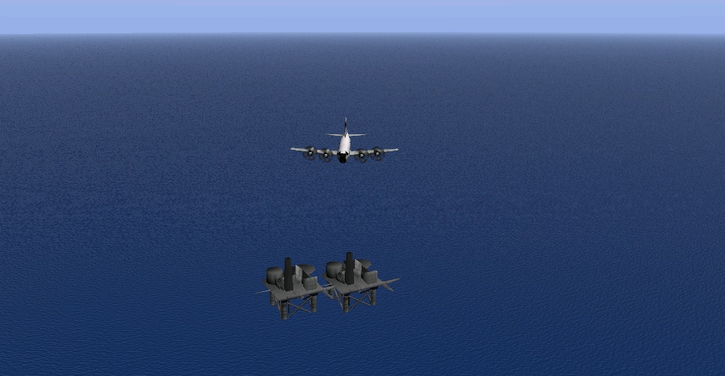 ****A HUGE thank you must go to FPSChazly for making his great 'line-marking' program.**** Installation: Place in your DW/Scenario folder - you know what to do! Disclaimer: Naturally, download at your own risk. I take no responsibility for any adverse effects to your computer by downloading these files. Feedback (and requests) welcome via the Subsim forums! Cheers! Stewy
__________________
"This officer has used my ship as his den of iniquity and my wardroom to carry him from bar to bar." |

|

|
 |
|
|


 Linear Mode

