
|
|
SUBSIM: The Web's #1 resource for all submarine & naval simulations since 1997
|
SUBSIM: The Web's #1 resource for all submarine & naval simulations since 1997 |
|
|
 09-11-22, 05:52 AM
|
#1 |
|
Bosun
 Join Date: Sep 2021
Posts: 64
Downloads: 327
Uploads: 0
|
Thanks GreenSo.
long way... for exemple i just finish Bergen, just for the Fjord of Bergen more 200 buoys. 
|

|

|
|
09-11-22, 03:02 PM
|
#2 | |
|
Grey Wolf
 Join Date: Apr 2019
Location: Germany
Posts: 885
Downloads: 587
Uploads: 7

|
Quote:
I do not have much time at the moment, because I have a lot to do in real life and cant do anything for SH5.
__________________
Best regards, GrenSo Mankind must put an end to war, or war will put an end to mankind. - J.F.K. |
|
|
|
|
|
04-24-23, 07:54 AM
|
#3 |
|
Bosun
Join Date: Sep 2021
Posts: 64
Downloads: 327
Uploads: 0
|
I made quite a bit of progress on this little navigable map project.
-Added all the white buoys -Added all the green buoys -Added all red buoys to -Added all lightships. All buoys and lightships present in games are now visible in their correct position in nav map. For information, they are more 2000 buoys on the map now. -Added more than 70 names of islands in the northern hemisphere -remove the grid system on the navigation map. -addition of the Kriegsmarine grid map in the user map. Some Pictures (click on the picture for have better quality) : North of Wihlelmshaven. 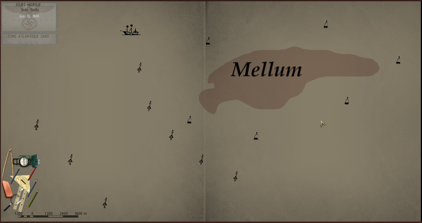 Groix island, front of Lorient. 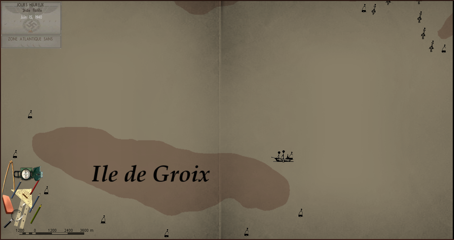 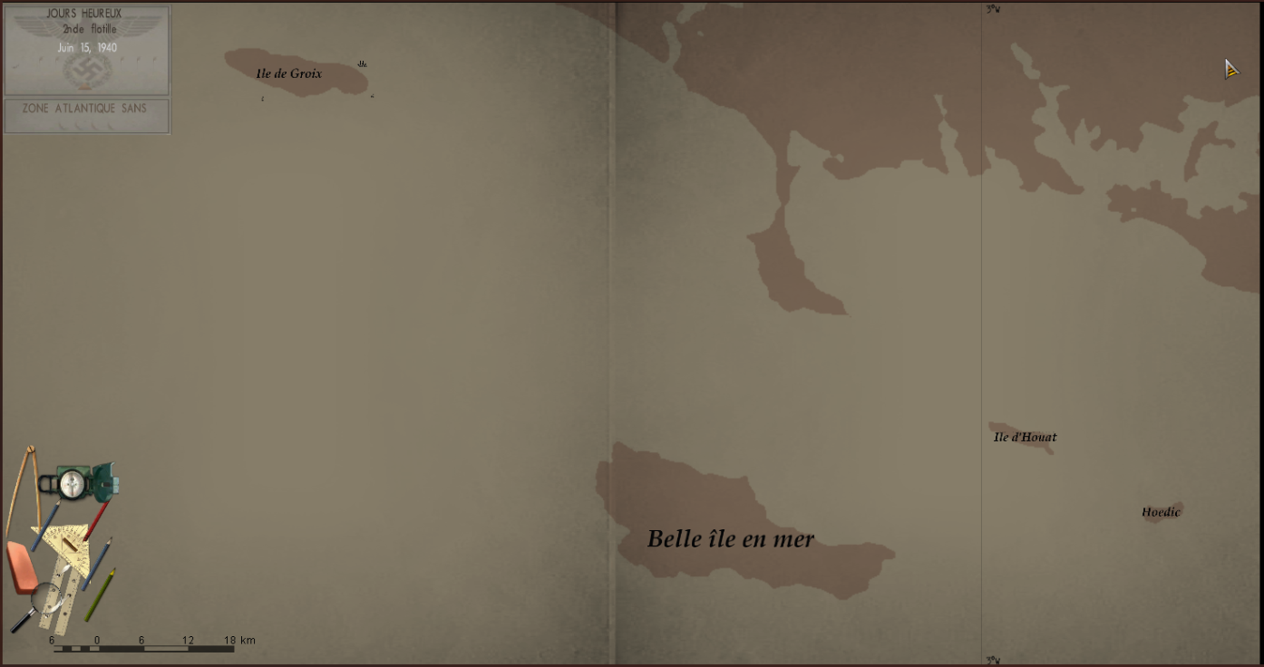 îles des açores 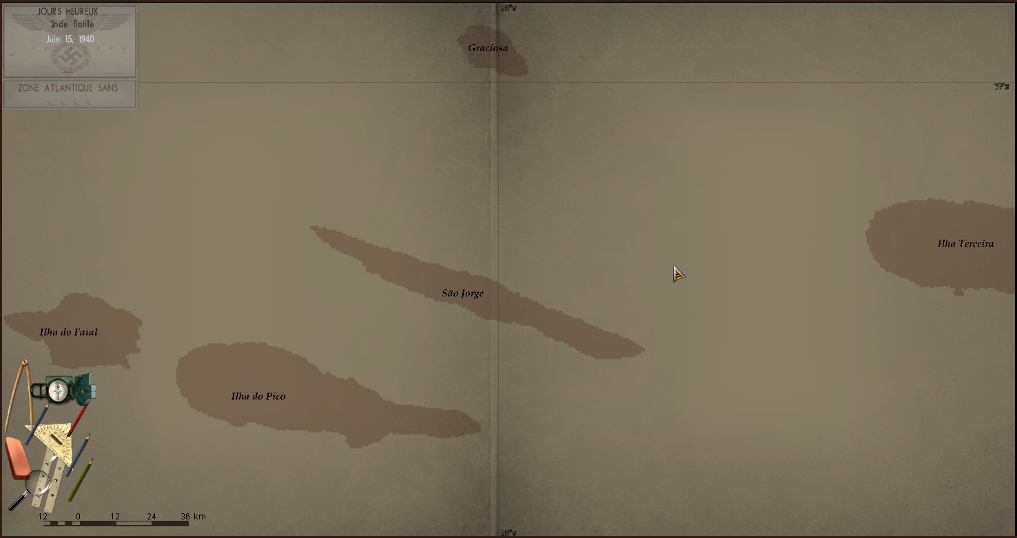 Bergen 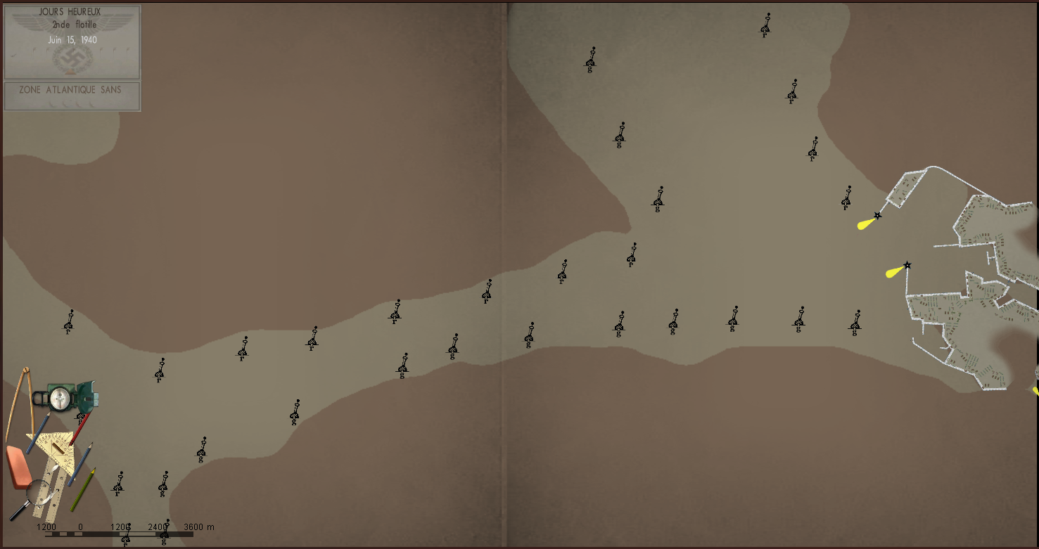 Next step : -finish adding the name of all the islands of the North Atlantic. -add the seas, oceans, rivers. -modify the number of zooms on the map, restrict to only 4 or 5 possible zooms. -add number indicating the depth at the level of the main ports and certain islands. -add numbers indicating the maximum height of certain islands. -add lighthouses on the French coast. -change the colors of the map to have a map closer to reality If any people want help me to advance, Do not hesitate to contact me !! Last edited by Dönitz78; 06-14-23 at 12:11 PM. |
|
|
|
|
04-24-23, 10:20 AM
|
#4 |
|
Grey Wolf
Join Date: Apr 2019
Location: Germany
Posts: 885
Downloads: 587
Uploads: 7
|
Nice

__________________
Best regards, GrenSo Mankind must put an end to war, or war will put an end to mankind. - J.F.K. |
|
|
|
|
06-14-23, 12:13 PM
|
#5 |
|
Bosun
Join Date: Sep 2021
Posts: 64
Downloads: 327
Uploads: 0
|
Harbor map V0.2 ready for download, first post for all indications
|
|
|
|
|
06-15-23, 01:22 AM
|
#6 | |
|
Grey Wolf
Join Date: Apr 2019
Location: Germany
Posts: 885
Downloads: 587
Uploads: 7
|
Quote:
It seems the link for version 0.2 is not correct, because the link goes already to version 0.1 from September 2022.
__________________
Best regards, GrenSo Mankind must put an end to war, or war will put an end to mankind. - J.F.K. |
|
|
|
|
|
06-15-23, 02:35 AM
|
#7 |
|
Bosun
Join Date: Sep 2021
Posts: 64
Downloads: 327
Uploads: 0
|
Effectively ! error of my part, it's corrected. Thanks Greenso !
Harbor map V0.2 ready for download, first post for all indications |
|
|
|
 |
|
|


 Hybrid Mode
