
|
|
SUBSIM: The Web's #1 resource for all submarine & naval simulations since 1997
|
SUBSIM: The Web's #1 resource for all submarine & naval simulations since 1997 |
 10-28-09, 01:08 PM
|
#1 |
|
Captain
 Join Date: Aug 2009
Posts: 481
Downloads: 71
Uploads: 3
|
Color:
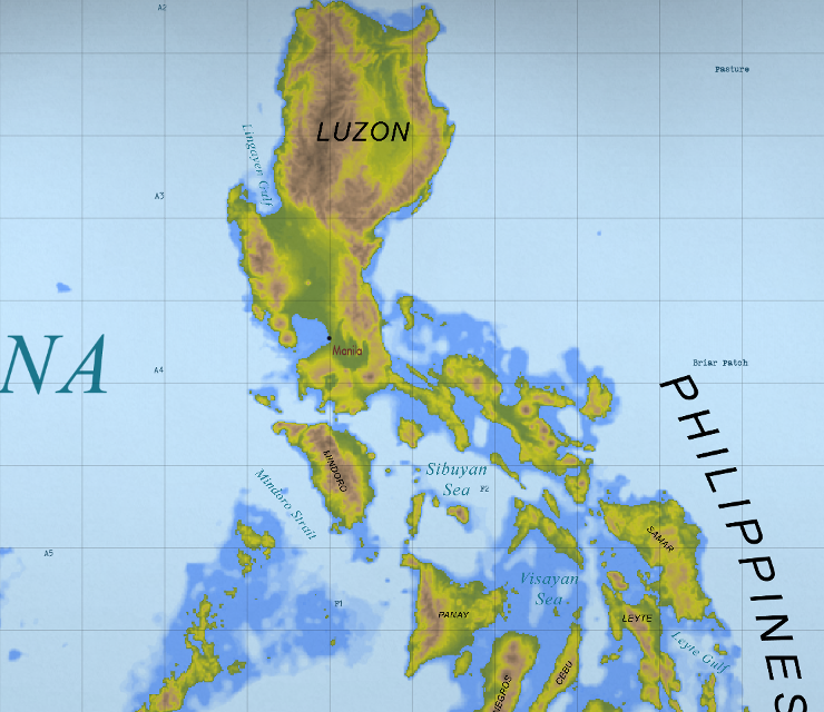 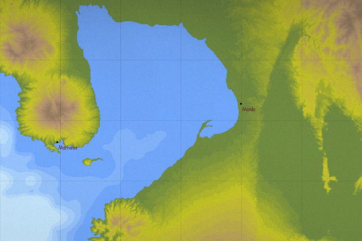 Historical: 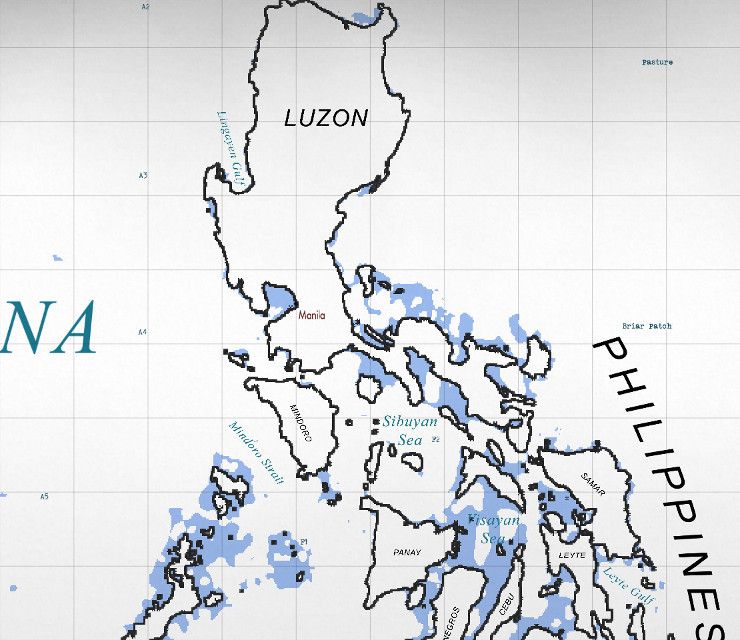 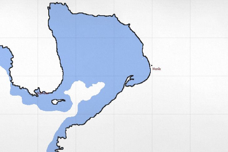 Classic: 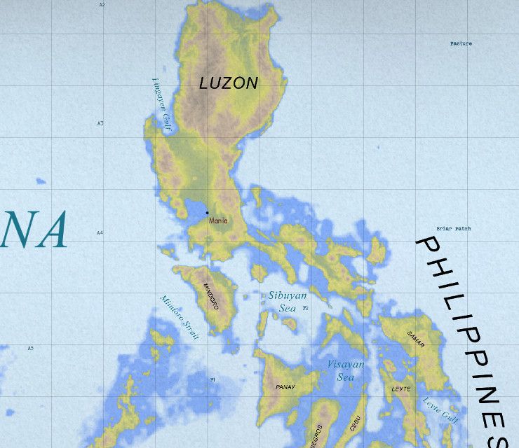 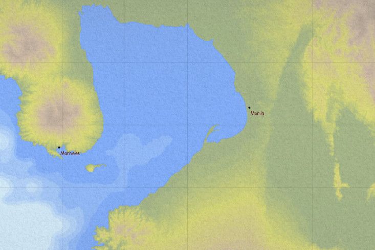 What this does: Real depth charts are color coded the other way around from the stock game. Corrected so that light blue is deep and dark blue is shallow. Improved contrast on the depth colors so that it's easier to tell some depths apart. Adds elevation information to land (except historic variant). Inspired by the standard height map color scheme that was on every general purpose map I ever saw growing up. Green is sea level, progressing to yellow, then brown, then finally black for very high altitude areas. This mod comes in 3 variants: Classic - A slightly tuned version of the original release of this mod. This version uses the shader from TMO 2.5. Included for your convenience. Color - An improved version of the classic variant. I modified the stock shader so that everything isn't as yellowed out as it is with the stock variant. I don't know what the game developers obsession was with making everything look like an antique. Historical - this version is as historically accurate as possible within the limitations of the game engine, based on actual charts from the period. Color is only used to mark very shallow waters. Historically, well known harbors would have had numeric depth labels in places, and there is no way to replicate this. In reality, most of the pacific wasn't charted particularly well anyways so not having particularly accurate information in enemy controlled areas is completely realistic with very few exceptions. Historical maps also show contour lines on land near the coast with hilltops labeled for navigational purposes. Again, this is not possible within the limitations of the game engine. Given that submarine position is always accurately known in silent hunter, this is a non-issue as far as functionality goes. Compatibility: Should be compatible with all other mods that do not do the same thing. It only alters two files that only effect the way the maps are drawn. Installation: JSGME ready Install using the normal JSGME method. If you want to be 100% sure that no other mod will overwrite this one, install this one last. License: I made this mod primarily for personal use and I really couldn't care less what you do with it. Download: http://www.subsim.com/radioroom/down...o=file&id=4772 Last edited by ColonelSandersLite; 09-23-15 at 12:17 PM. |

|

|
|
10-28-09, 02:40 PM
|
#2 |
|
Stowaway
Posts: n/a
Downloads:
Uploads:
|
address removed for basic safety and common sense reasons
 please dont ever put your address in a public forum, there are just too many crazy people in this world. i strongly recommend you remove it from your mods read me as well ps - it wouldnt hurt to remove the (****) stuff too |
|
|
|
10-28-09, 03:26 PM
|
#3 |
|
Captain
Join Date: Aug 2009
Posts: 481
Downloads: 71
Uploads: 3
|
As stated in pm, it's not my address, but the address of the guy who wrote the license and is part of the legal document.
Last edited by ColonelSandersLite; 10-28-09 at 04:08 PM. |
|
|
|
|
10-28-09, 04:16 PM
|
#4 |
|
Stowaway
Posts: n/a
Downloads:
Uploads:
|
the mod looks great

|
|
|
|
10-28-09, 05:40 PM
|
#5 |
|
Watch Officer
 Join Date: Nov 2007
Location: Montreal, QC
Posts: 345
Downloads: 614
Uploads: 10
|
I love it, good job!

__________________
11 War Patrols / 56 ships sunk or damaged for 212,022 tons Zero casualties throughout the war Scuttled on 8 May, 1945 in Sonderburg Bay, after German surrender |
|
|
|
|
10-28-09, 07:42 PM
|
#6 |
|
Sink'em All

Join Date: Mar 2001
Location: Naperville, IL
Posts: 2,150
Downloads: 305
Uploads: 1


|
Nice job! Thanks for your efforts.
__________________
Head Deep and Keep'em Astern" - LtCDR Samuel D Dealy SHIV Guide | Imperial Japanese Navy | US Submarines |
|
|
|
|
10-29-09, 11:28 AM
|
#7 |
|
Grey Wolf
 Join Date: Mar 2005
Posts: 762
Downloads: 55
Uploads: 0
|
Very nice. I particularly like the land mass colors. I have to say though, the ocean colors seem backwards--I would think the deeper the water the darker blue, and the shallower the lighter (kinda like RL). Personal choice I guess.
Well done. |
|
|
|
|
10-29-09, 11:30 AM
|
#8 |
|
Stowaway
Posts: n/a
Downloads:
Uploads:
|
Cool, like the elevation colors as well.
|
|
|
|
10-29-09, 01:28 PM
|
#9 | |
|
Ocean Warrior
 Join Date: Dec 2007
Location: Between test depth and periscope depth
Posts: 3,021
Downloads: 175
Uploads: 16
|
Quote:
__________________
USS Kentucky SSBN 737 (G) Comms Div 2003-2006 Qualified 19 November 03 Yes I was really on a submarine. |
|
|
|
|
|
10-30-09, 07:24 AM
|
#10 | |
|
The Old Man
 Join Date: Aug 2006
Location: Yonkers, NY U.S.A.
Posts: 1,507
Downloads: 146
Uploads: 0
|
Quote:
I was wondering about that. I know present day charts are displayed like this, but what about in WWII? It's outstanding work, and a huge improvement, but being a realism buff, I need to ask about the historical accuracy of colored depth charts in WWII. Mabey there was. I don't know. I don't even know if the charts we have in the game now are accurate for the period. Probrably not. That would be a good project for one of our mod wizards! 
|
|
|
|
|
|
10-30-09, 07:29 AM
|
#11 | |
|
Ocean Warrior
Join Date: Dec 2007
Location: Between test depth and periscope depth
Posts: 3,021
Downloads: 175
Uploads: 16
|
Quote:
__________________
USS Kentucky SSBN 737 (G) Comms Div 2003-2006 Qualified 19 November 03 Yes I was really on a submarine. |
|
|
|
|
|
10-30-09, 09:58 AM
|
#12 | |
|
Captain
Join Date: Aug 2009
Posts: 481
Downloads: 71
Uploads: 3
|
Quote:
Anyways, I can't say I'm a period chart specialist, but I have seen just a few pretty dang old charts, though I don't know their year. Those where actually plain white (no colored pigments at all) with labels printed in black. No way to do that in game though. On the subject of them ever being color coded as in the stock game at one time or another, I have to say that this is unlikely. There's a somewhat noticeable habit of not changing the way things are without a *good* reason. When putting pigments on charts to represent depth became a practice, there was probably some mixed practices (think beta vs vhs or hd dvd vs bluray) but once things started to go a certain way, it probably just stayed that way. There's really just no point to changing the color coding on your depth charts after 20 years just to confuse people. I wouldn't be surprised if the real reason charts are printed like that came from an early cost analysis that said, "Hey guys, we can save pigment, and thereby money, if we make deep light blue (or even plain white) because around 2/3 of the planets surface is deep water!" Sure doesn't make much of a difference on an individual chart's cost, but when you're printing a few million of them... The way I've got it set up in this mod is probably as close to period American charts as you're going to get within the limits of the game. I say American, because it's not out of the realm of possibility that other countries have totally different conventions. Last edited by ColonelSandersLite; 10-30-09 at 10:10 AM. |
|
|
|
|
|
10-30-09, 10:02 AM
|
#13 |
|
Sea Lord
 Join Date: May 2008
Location: London UK
Posts: 1,788
Downloads: 405
Uploads: 29
|
Using this now - really nice job mate
|
|
|
|
|
10-30-09, 01:31 PM
|
#14 |
|
Navy Seal
 Join Date: Mar 2007
Location: DeLand, FL
Posts: 8,899
Downloads: 135
Uploads: 52


|
Good job CSL! As far as historical reality, RFB has the corner on that with their charts. However, there's plenty of room for dispensing with strict historical reality in favor of clear and easy to read charts made in agreement with modern chart-making methods. You are correct about the reversal in colors.
If you check out the RFB charts, you can see that they also reverse the colors. There was much less detail in the depth rendering and very little detail on land mass elevation rendering. Often the WWII guys had no real charts at all and used National Geographic insert maps. Therefore, even RFB maps are not historically accurate in many areas. I don't know that there is any way to simulate the use of different charts of various scales and accuracies, with some areas of the Pacific not having any charts at all, as the real subs had. Certainly, there are no historically accurate coffee stains on any charts I've seen!  That being the case, there is no such thing as "historically accurate" here and you have a blank check to do as you please! I really like your charts.
__________________
Sub Skipper's Bag of Tricks, Slightly Subnuclear Mk 14 & Cutie, Slightly Subnuclear Deck Gun, EZPlot 2.0, TMOPlot, TMOKeys, SH4CMS |
|
|
|
|
10-30-09, 03:17 PM
|
#15 | |
|
Captain
Join Date: Aug 2009
Posts: 481
Downloads: 71
Uploads: 3
|
Quote:
|
|
|
|
|
 |
|
|


 Linear Mode

