SUBSIM Radio Room Forums


SUBSIM: The Web's #1 resource for all submarine & naval simulations since 1997

Go Back   SUBSIM Radio Room Forums > General > General Topics
Forget password? Reset here

Reply
 
Thread Tools Display Modes
Old 09-03-23, 06:22 AM   #1
Jimbuna
Chief of the Boat
 
Jimbuna's Avatar
 
Join Date: Feb 2006
Location: 250 metres below the surface
Posts: 181,265
Downloads: 63
Uploads: 13


Default Doomed flight MH370 'found' in darkest part of Cambodian jungle' on Google Maps

If this turns out to be true then many families will be able to come to some form of closure.

Quote:
A tech expert from the UK claimed he spotted the doomed MH370 plane on Google Maps.

Ian Wilson believes remains of the missing Malaysia Airlines plane, which vanished carrying 239 people en route from Kuala Lumpur to Beijing, lie strewn deep in a jungle in Cambodia. He said: "Measuring the Google sighting, you're looking at around 69 metres, but there looks to be a gap between the tail and the back of the plane. It's just slightly bigger, but there's a gap that would probably account for that."

The ill-fated plane flight took off from the Malaysian capital on March 8, 2014, with 227 passengers on board and 12 crew. But it disappeared during a handover between Malaysian and Vietnamese air-traffic controllers with the transponder shut down.

Mr Wilson said: "I was on there [Google Earth], a few hours here, a few hours there. If you added it up I spent hours searching for places a plane could have gone down. And in the end, as you can see the place where the plane is. It is literally the greenest, darkest part you can see."

Investigators have worked extensively since the plane vanished. However, despite releasing a 1,500-page report, they admitted they still cannot say what happened. And the Bureau of Aircraft Investigations Archives said they could not rule out the Google Maps sighting – dating 2018 on Google Earth – being MH370.

Academics in Florida also believe that temperature data held by barnacles found on parts of the plane's debris may provide the answer. It is thought that this could help track the movements of the sea creatures all the way back to when they first attached themselves to MH370.

Gregory Herbert, an associate professor of evolutionary biology at the University of South Florida in the city of Tampa, led the new study after seeing photos of the plane debris - specifically a flaperon - washed up on Reunion Island in the Indian Ocean a year after it disappeared.

He said, "As soon as I saw that, I immediately began sending emails to the search investigators because I knew the geochemistry of their shells could provide clues to the crash location," reports MailOnline. Because barnacles grow their shells daily it means that the chemistry of each layer can be determined by the temperature of the water at the time.
https://www.msn.com/en-gb/news/world...44e1d876&ei=17
__________________
Wise men speak because they have something to say; Fools because they have to say something.
Oh my God, not again!!


GWX3.0 Download Page - Donation/instant access to GWX (Help SubSim)
Jimbuna is offline   Reply With Quote
Old 09-03-23, 06:35 AM   #2
em2nought
Ocean Warrior
 
Join Date: Mar 2004
Posts: 3,275
Downloads: 0
Uploads: 0
Default

It doesn't look like it's in too bad of a condition. Imagine if many lived and either waited for rescue, or tried to hike out. Has the makings of a real Donner Party type story.
__________________
Looks like we need a Lemon Law for Presidents now! DNC sold us a dud, and they knew it.
em2nought is offline   Reply With Quote
Old 09-03-23, 06:53 AM   #3
Rockstar
Rear Admiral
 
Join Date: Nov 2002
Location: Zendia Bar & Grill
Posts: 11,845
Downloads: 10
Uploads: 0


Default

A tech expert from the UK claimed he spotted the doomed MH370 plane on Google Maps.


Who allows crap like this to be reported.
__________________
Guardian of the honey and nuts


Let's assume I'm right, it'll save time.
Rockstar is offline   Reply With Quote
Old 09-03-23, 07:59 AM   #4
Reece
CINC Pacific Fleet
 
Reece's Avatar
 
Join Date: Sep 2003
Location: Down Under
Posts: 32,761
Downloads: 171
Uploads: 0
Default

^ Google maps!! You're kidding??
__________________

Sub captains go down with their ship!
Reece is offline   Reply With Quote
Old 09-03-23, 09:12 AM   #5
Buddahaid
Shark above Space Chicken
 
Buddahaid's Avatar
 
Join Date: Jun 2008
Posts: 8,561
Downloads: 160
Uploads: 0


Default

Quote:
Originally Posted by Rockstar View Post
A tech expert from the UK claimed he spotted the doomed MH370 plane on Google Maps.


Who allows crap like this to be reported.
The same type of people that use doctored photos to claim energy weapons from space started the fire in Hawaii.
__________________
https://imagizer.imageshack.com/img924/4962/oeBHq3.jpg
"However vast the darkness, we must provide our own light."
Stanley Kubrick

"Tomorrow belongs to those who can hear it coming."
David Bowie
Buddahaid is offline   Reply With Quote
Old 09-03-23, 09:41 AM   #6
Rockstar
Rear Admiral
 
Join Date: Nov 2002
Location: Zendia Bar & Grill
Posts: 11,845
Downloads: 10
Uploads: 0


Default

Quote:
Originally Posted by Buddahaid View Post
The same type of people that use doctored photos to claim energy weapons from space started the fire in Hawaii.
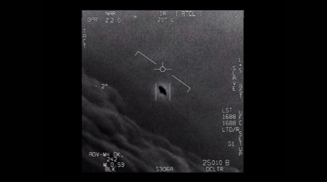
And why not? By those “type of people” do you include official government sources and congressional investigations reporting alien technologies piloted by non-human beings buzzing around the skies too?

__________________
Guardian of the honey and nuts


Let's assume I'm right, it'll save time.

Last edited by Rockstar; 09-03-23 at 02:16 PM.
Rockstar is offline   Reply With Quote
Reply


Posting Rules
You may not post new threads
You may not post replies
You may not post attachments
You may not edit your posts

BB code is On
Smilies are On
[IMG] code is On
HTML code is Off

Forum Jump


All times are GMT -5. The time now is 03:50 AM.


Powered by vBulletin® Version 3.8.11
Copyright ©2000 - 2024, Jelsoft Enterprises Ltd.
Copyright © 1995- 2024 Subsim®
"Subsim" is a registered trademark, all rights reserved.