Quote:
Originally Posted by gap

Should we edit the SHIII terrain so to add the Pointe du Raz and Chausée de Sein in game?
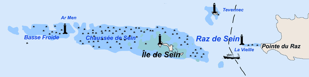
From your screenshot of the ME map, I don't see them simulated in game. Both La Vieille and La Plate lay on the offshore extension of the Pointe du Raz with a sea depth ranging from ca. -10 to -14 m between the two lighthouses (measured in Gooogle Earth). In game, the depth of both locations is -17 which is reasonably close, but maybe we can do better, and recreate the submerged ridges as closely as possible with the limited resolution of SHIII's depth map |
I would like to correct all the sea depth of the area which is on the map I've posted.

How can you modifiy the sea depth / terrain altitude with terrain editor ? I've never used it. Do you have to just change the color ? Is it a grey scale ?