Quote:
|
Originally Posted by Mav87th
Problem is that the image are compressing near the center. This was true for SH3 as well. As far as i could see it happend inside 1° from center only.
|
Hi Mav, I finally got some spare time to take a look at this. First of all, sorry if I have miunderstood what you are saying, but I think you are saying that the stadimeter doesn't measure correctly, due to some shortening of height in the lower half of the scope?
Well, my investigations have concluded you are right, but in a very strange way. What's actually happened, is the measurements are correct, but the waterline is receeding due to the distance and the horizon obscurring it. Some maths calculations tell us that as the Earth's surface is curved, then an object will be obscured by the horizon so you will no longer be able to see its base. As such, you only see the tops of masts over the horizon at long distance. Of course you know this! What's fooling you is that the horizon isn't modelled quite right. The game uses some sort of strange pseudo horizon that makes the ship sink into the water. The further away the object, the further it sinks into the water.
This would be correct and acceptable, if the rendered horizon were level with this pseudo horizon, but it isn't. I have done some testing with high power (up to 20x) magnification and have observed the water appears to be flat with no curvature and extends out to what seems to be about 10nm or 20km. At that exact distance objects actually are rendered on the rendered horizon and it is flush with the pseudo horizon. A rise and fall of the camera will show no paralax movement of the pseudo horizon and rendered horizon. Moving back further, so the ship moves more than 20km out, the ship is obviously rendered behind the horizon as you can see over the edge of the end of the sea and the pseudo horizon is no longer a factor, as there is no water to sink the ship into. Moving the camera up and down to change height will cause anything rendered behind the sea plane to rise and fall due to the paralax of the edge of the sea and the object.
OK, this is all very hard to explain, perhaps some screenshots would help. the first shot is showing the same ship you used in your example, the medium European composite freighter stationed at distances of 1km, 2km and 4km (there was an 8km one, but it was a bit too fogged and unclear) and zoomed in to 4x, 8x and 16x to give the same relative sizes. The following picture are slightly misleading, as I have arranged them so that the
deck lines up, not the waterlines, although it should be noted that the ship does actually sink into the sea, rather than staying at the same height. The picture is only arranged like this to give you a clear indication of the effect.
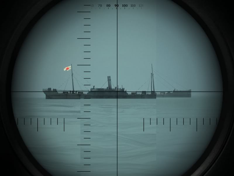
You can see that the horizon on the right hand side appears higher than the horizon on the left hand side of the picture. The horizon stays level, it is only raised due to my arrangement of the picture, aligning the decks up, that the hirizon is not level.
The effect of objects being drawn at distances further than the rendered horizon can be seen in the following picture:
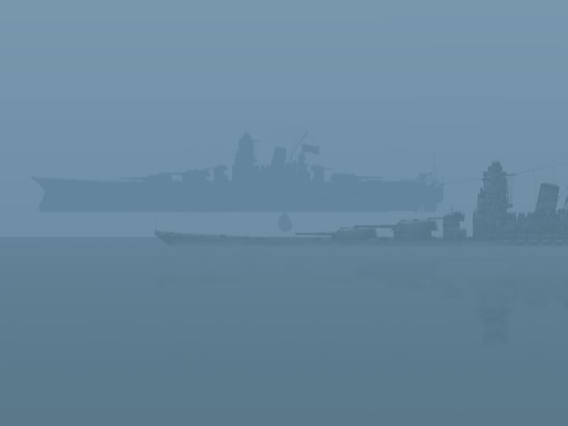
The round blob between the two Yamato ships is actually my submarine and that it has been drawn above the sea, due to the paralax caused by the height and the distance between the submarine (and yamato) and the edge of the sea. For the Yamato in the foreground ( at the bottom), note the height of the deck above the water and then compare that relative height to the height of the guns. Now see in this picture, the true relative heights at close range:
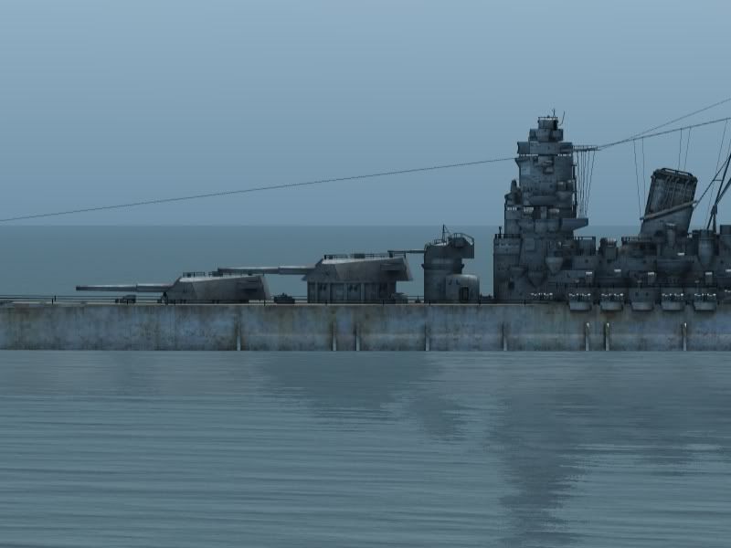
This serves to illustrate the ships sinking into the water effect which causes stadimeter readings to be off. I think the pseudo horizons being calculated and displayed are probably correct, but it's unfortunate that the psuedo horizon effect doesn't meet the rendered horizon, as it makes your sight picture seem as if you
can see the waterline when in fact you
cannot.
Now, it's accurate that in real life situation you would not always be able to see the waterline or mast and the submarine manual advises captains to take measurements from any two horizontal surfaces they could see clearly, the stadimeter is after all just an angle measurer. The angles measured for portions of the ship not including the waterline are correct and can relaibly be used to measure range (I think, but haven't checked), if you know the height difference between the deck and the mast for example, or if you can calibrate your stadimeter with the radar and measure the deck to mast height that way.
The pseudo horizon effect seems to start at about 1000 yards / 1km, which may explain why you were able to get accurate ranges up to that point. After that, stadimeter readings taken with the same mast height will give readings saying that the target is progressively further away than it actually is, but the target
is drawn at the correct range, it's just got a pseduo horizon. Measuring the horizontal angle would confirm the ships are rendered at the correct distance.
Interesting eh? By the way, these pics were taken on an unmodded game installation. It certainly explains the 1 degree compression effect.