I had an idea about this. Feel free to shoot me down in flames.
Rather than posting screenshots I thought you could take angles from the 'corners' of the KM grid as a reference to triangulate the position of the sounding.
Take a look at this (aplogies for the crude sketch):
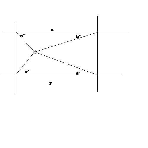
If you set a standard like the angles were always measured from the horizontal line to the u-boat then you'd get a pretty accurate fix for the sounding.
You could then state that all emails/sounding reports must have a format of something like
DEPTH/ANGLE A/ANGLE B/ANGLE C/ANGLE D
i.e.
56/30/32/47/86 (don't try to draw these, I made them up in my head)
This could then be interpreted by a program later, or just used as a standard for the fields.
Let me know if this sounds complete bollocks or not.