Hydra, I've been further checking and I'm at a quandary as to what to do about this 1 degree discrepancy. The follow images are from a game using 1600x1200 resolution.
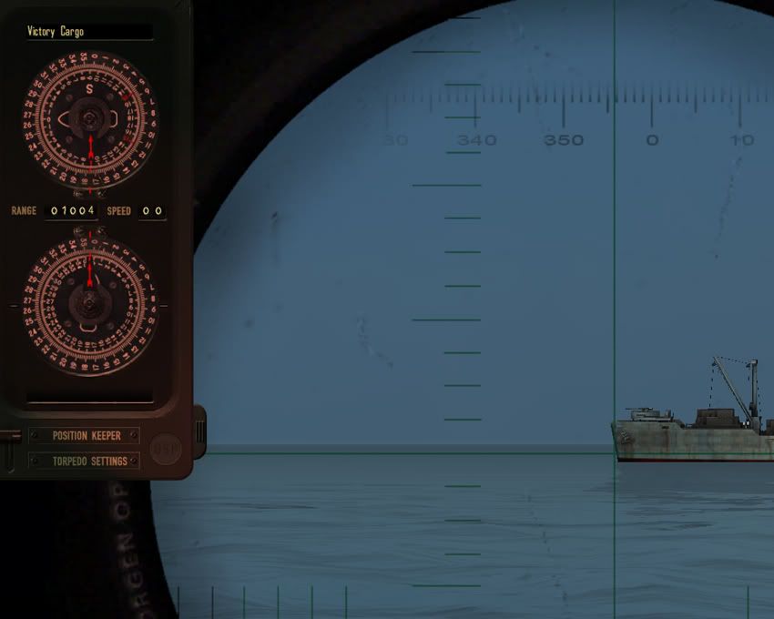
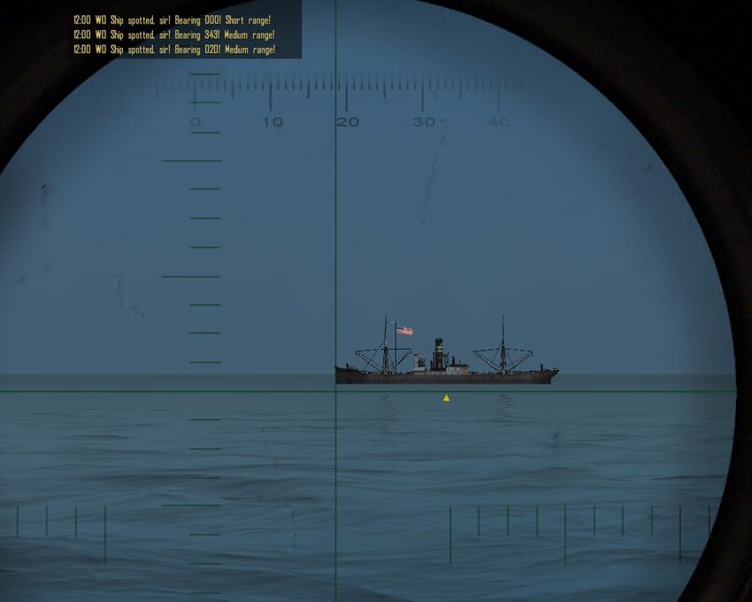
The first image is at the periscope station with a ship at 1004 yards distance. The bow is centered on a compass reading of almost 356 degrees.
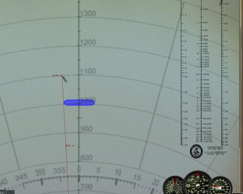
So we go to the navigation map and the same ship is at the correct range but the compass reading is at 357 degrees. Ah Haa! Here's the discrepancy we've been talking about.
So I go to check another ship sitting out at the 3000 yard range and find it's bow at almost the 342 degree mark.
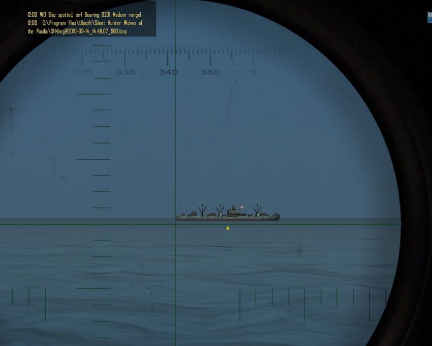
But wait, the bow reading is just half a degree off from what the periscope compass read!?! You would think the reading should read at least the same difference as the 1000 range ship.
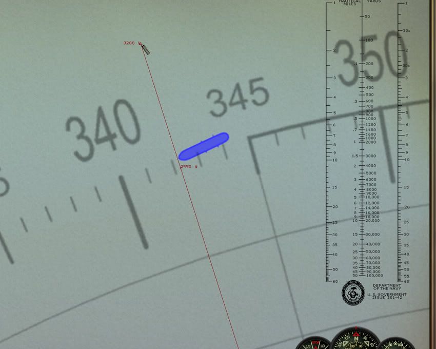
And here's a third target sitting at 1500 yards, with a bow compass reading of 18 1/2.
The same ship on the plotter reads exactly 18 degrees.
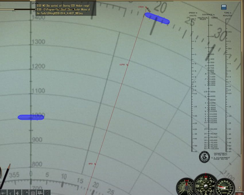
So here's the rub, if I move the plotter the 1 degree clockwise to correct the first ships discrepancy, the ship at the 1500 yard position will end up with it's bow at the 17 degree mark. So we correct one and make worse another. Actually the 3000 yard ship would be a wash, it is only a half degree off when compared to the periscope compass. Moving the plotter clockwise by one degree will have it then at a half degree difference on the other side of 342. I've checked this with a couple of other resolutions and have found the same differences.
So unless I see a positive reason to change things, I'm just as well to let the sleeping dog lie. Compared to what the dev's gave us when the game first came out (the measuring units were in Nautical Miles for crap sake!!!!) one degree difference is dead on target to me.
Quote:
|
Originally Posted by Hydra
.......0 degrees on the plotter tool was different from one's plotted course.
|
I've seen this too, you plot a course on the navigation map and the plotter will ride along the path 1 degree off center. Did you notice which side the 1 degree difference is on? It depends on whether you make a left turn or a right!? If the plotter was consistently on the right side of the centered zero the fix would be to move the image one degree clockwise and all would be fine with the world!! But when the turns the ship takes makes the 1 degree mark either on the left or the right of center, this is a problem held within the game. No fault of ours, thank the dev's for it. The point is, the game didn't have plans for a bearing plotter so why would the dev's worry about the waypoint paths coming up one degree short after a change in direction!? I pointed out the Nautical Mile units on the ruler, this change didn't happen until the 4th patch. The fix's in the game come slowly and some just won't come at all.