Here is a prototype I just made. The changes were a bit hard to spot, so just for this image, I recoloured the polar region yellow.
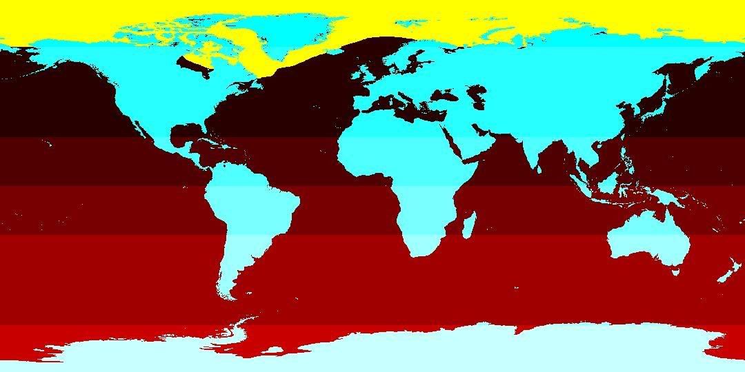
The polar region now follows the boundary in the reference picture I linked to. As you can see, the temperate climate zone is pushed up in the north-eastern Atlantic, and down in the Greenland/North America region. Should make those Arctic convoy hunting missions a bit more cosy.
Okay, so what I've done is convert a tga file to bmp, edit it in Paint, and convert it back to tga. It's really a five-minute job that anyone can do, and it's untested and may not even work at all (would be quite an undertaking to properly test it, actually), but I guess it can't hurt to upload it for whoever wants it. Get it
here.