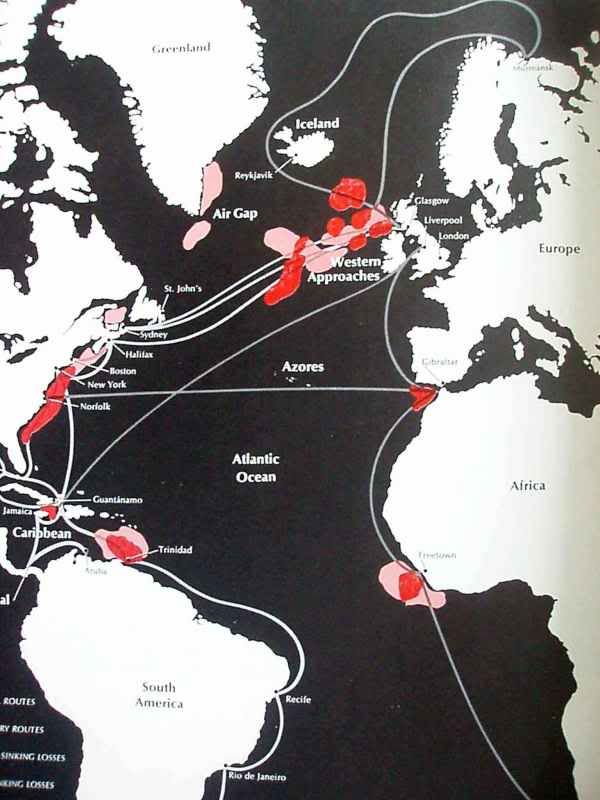
Here is a map I found in an old Time-Life book (The Battle of the Atlantic, page 98). What I found interesting was the large amount of activity that occurred in the Caribbean. I was pretty unaware of this fact.The dark red areas are where the most number of sinkings occurred. White lines are Principal routes, gray lines are Secondary routes, red color-heaviest sinking areas, pink color-large sinking losses. Sorry for the poor reproduction as I had to take a pic of it. I thought I would share with those who would find it as interesting as I did.
Here's the caption included with the map:
"The Battle of the Atlantic centered around the shipping routes shown here. Areas where the greatest numbers of ships were sunk are indicated in red, with the heaviest losses in deep red. The U-boats began their attacks in the Western Approaches, near Britian, and later divided their effort between the Greenland area and the coast of Africa. Next the East Coast of the United States became the main target region. Then the subs moved down to the Caribbean, before returning to the area west of Britain."