Quote:
Originally Posted by piri_reis

Just wanted to pass a message from Pintea.
Here's how to use the harbor layout in Mission Editor.
Add the data\Terrain\LocationMaps\editor_locations.mis as an "Existing Mission" to your project. This will add many Map Location objects to your project. (Which will overlay the corresponding dds graphics files located in the same folder)
To edit and view these you have to turn on the "Map Locations Edit Mode". And zoom in to observe.
|
Many thanks Piri_Reis,
Best regards
Karl
P.S.:
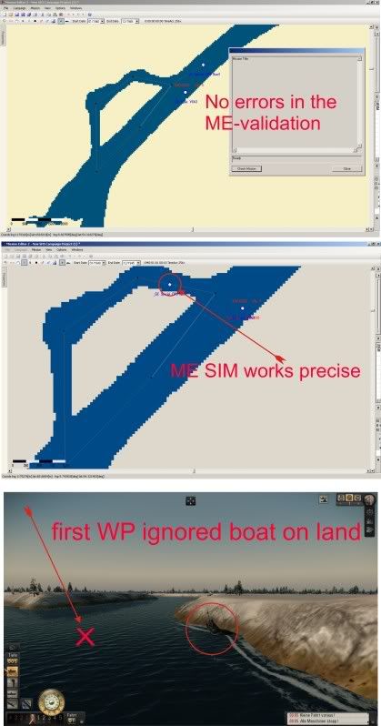
Have you seen the big mistake within the ME.
I had located some waypoints with no smaller distances as 1000 meter for a smal AI-Trawler. And now the crux:
ME simulates the path correctly!

But the game doesnt do that.

Oh, I know it is an old bug since SH3 but this makes coastal and harbor traffic impossible.

The reason is that some people were angy about collisions of ships, and so there was a patch to solve that. But now ships do not goal following waypoints exactly or they ignore the one or other.
I think it is better to implement the same exact waypointfeature as of the players boot.
It should be the work of the missionauthor to do that good or bad, only.
See the pictures:
Because this is not moddable to solvew this problem.
I hope you and the other serious modder will submit my opinion, otherwise you can forget a precise and well working traffic near coast an near Habors.