First real Navigation with help of dead recon, sunset- and celestial-navigation.
xxxxxxxxxxxxxxxxxxxxxxxxxxxxxxxxxxxxxxxxxxxxxxxxxx xxxxxxxxxxxxxxxxxxxxxx
(1)
4 1/2 min after Sunset near Bornholm (in the right side of the photo) at real position 55.00,00N 15.00,00E

I read a sunset (upper-limb of the sun fully disappears behind the horizon) at 18:15:50 GMT.
But at my actual position of 55.00,00N 15.00,00E the sunset had to be at 17:53:00 GMT according
to this
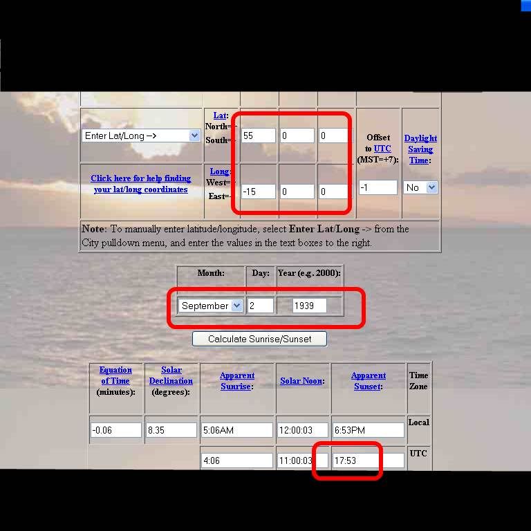 http://www.srrb.noaa.gov/highlights/...e/sunrise.html
Sunsetcalculation for a specific time and location.
So this gives me an error of 5°40' because the sunset at 18:15 GMT for Sep 02 1939 is at location 009°20E, 15°00N which gives me an
error of 361.3 km (
http://www.movable-type.co.uk/scripts/latlong.html ).
(2)
Actual Moon at 02-Sep-1939, 21:00 local time
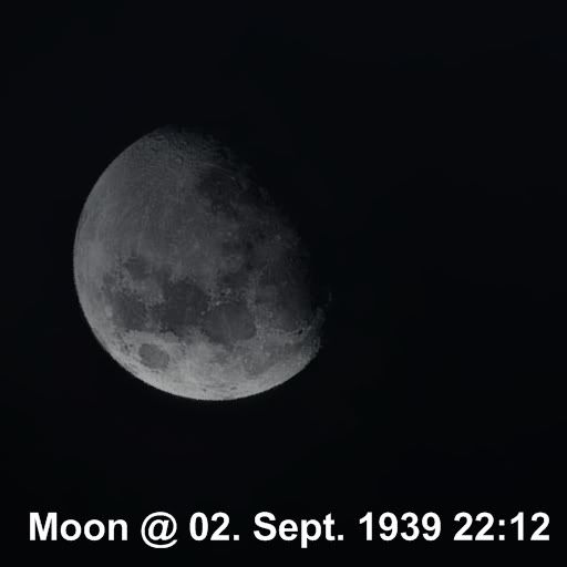
The moon-display could be correct because the correct phase of the moon
(according to
http://www.maa.mhn.de/StarDate/moon1939.txt ) is
Full moon 29-Aug-1939, 22.16
Last quarter 06-Sep-1939, 20.41.
(3)
Celestial navigation with Polaris (north star).
Polaris + sextant gives me a position of 53°09N.
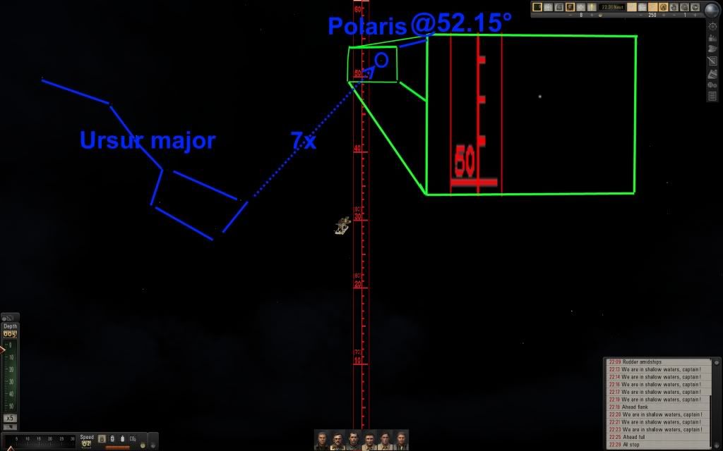
The reading was 52.15 + 1 (correct the misleading of polaris) = 53.15 = 53°09'.
But i am at position 55°00N. So the Polaris gives me an error of 1°51' = 205.7 km.
(
http://www.movable-type.co.uk/scripts/latlong.html )
(4)
My Route with dead reckon-navigation in real time:
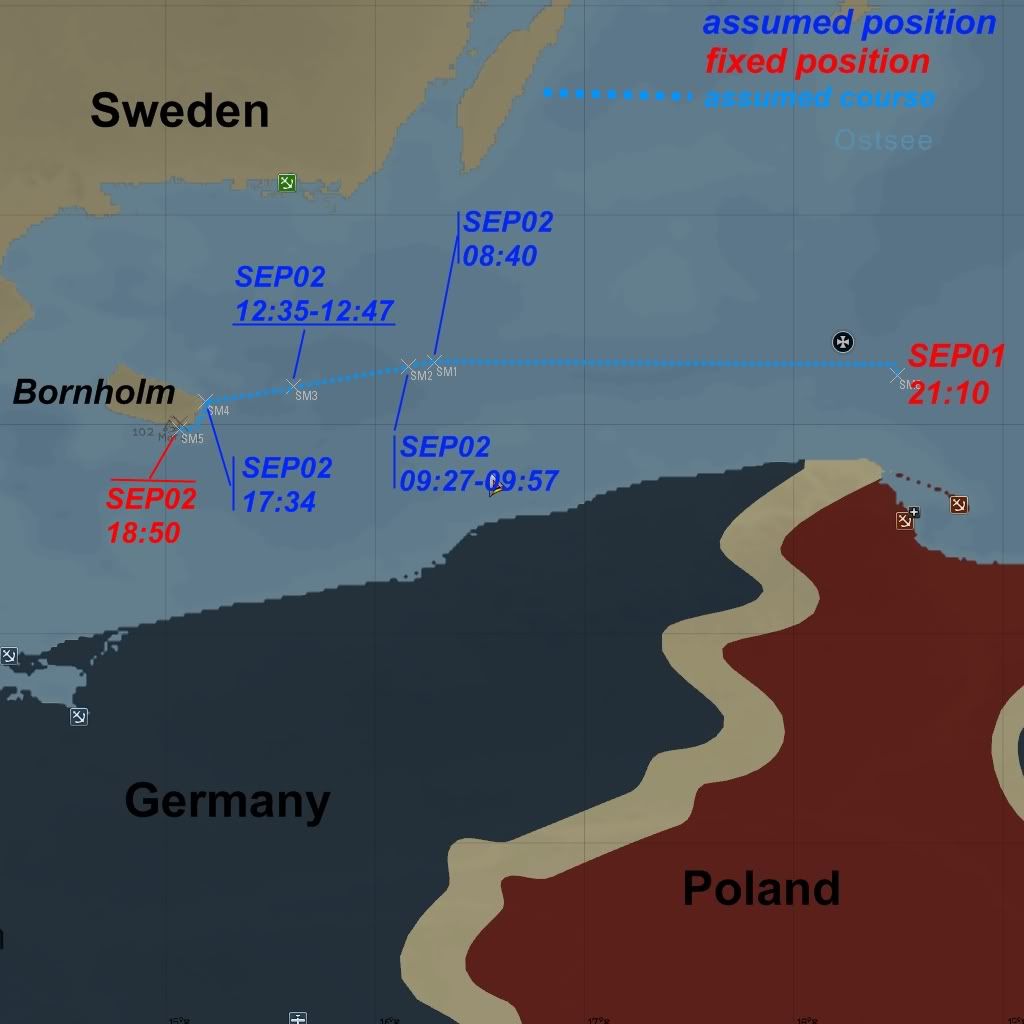
The fact that i reached Bornholm (that was my intention) surprised me and was not so bad.